
Live Hurricane Path Tracker
StormAtlas tracks hurricane formation, intensity evolution, and forecast tracks in the Atlantic and Eastern Pacific. Featuring satellite imagery, maximum sustained winds, minimum central pressure, and historical databases.
🌐Showing your local time
Current Active Storms
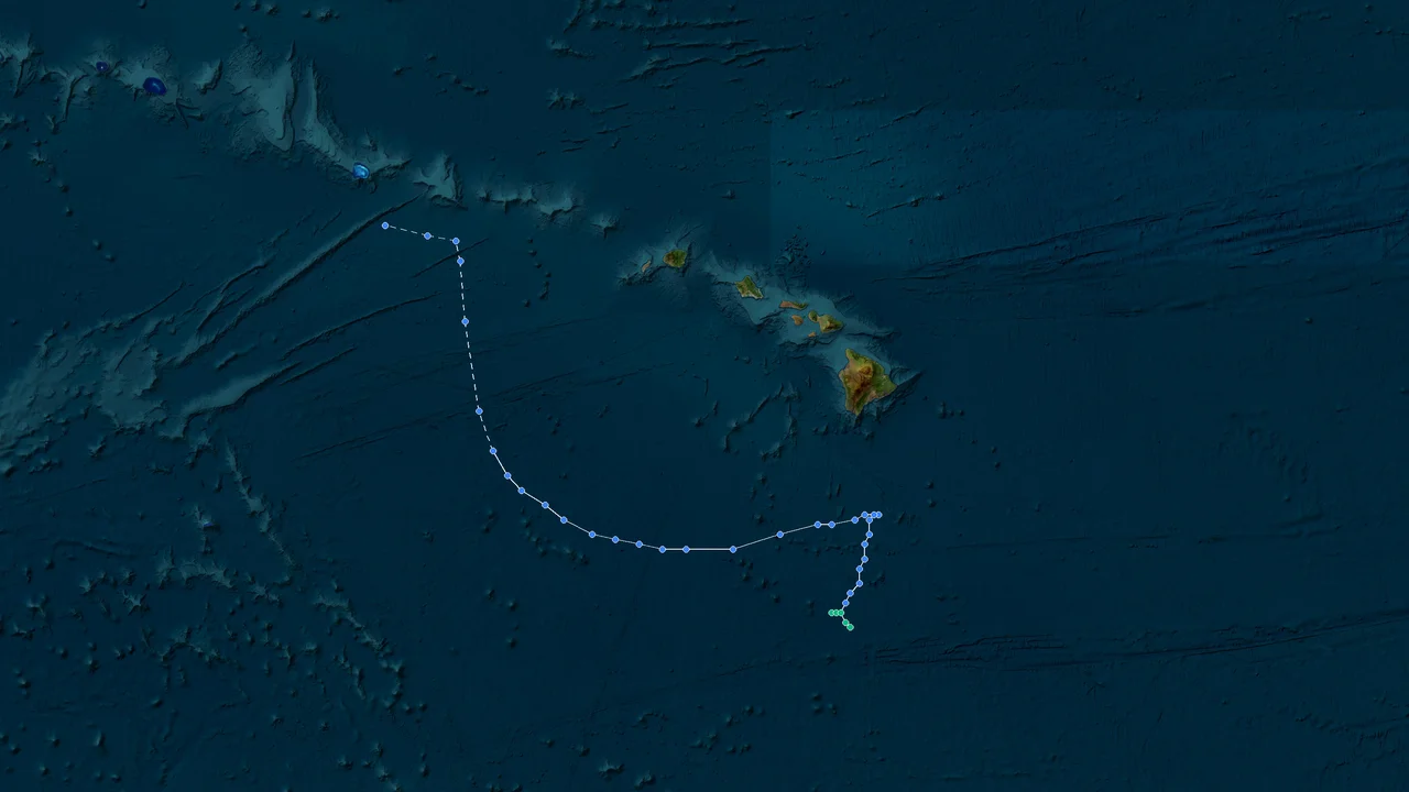
Tropical Depression Nolo (2026)
Formation Time: 23 Sep 2026 14:00 GMT-10
Formation Location: East Pacific(14.6°N, 155.8°W)
Max Wind Speed: 284 km/h
Min Pressure: 900 hPa
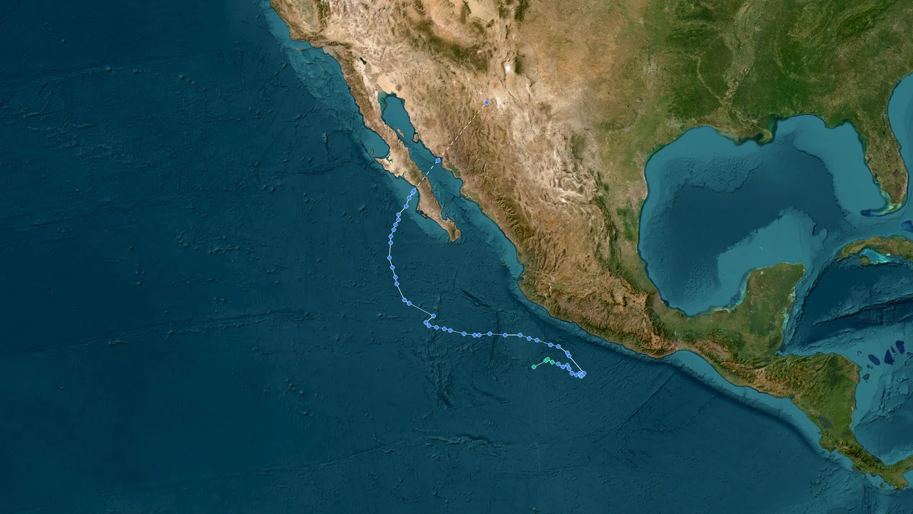
Tropical Depression Polo (2026)
Formation Time: 20 Sep 2026 20:00 GMT-7
Formation Location: East Pacific(15.1°N, 104.6°W)
Max Wind Speed: 284 km/h
Min Pressure: 892 hPa
Historical Storm Database
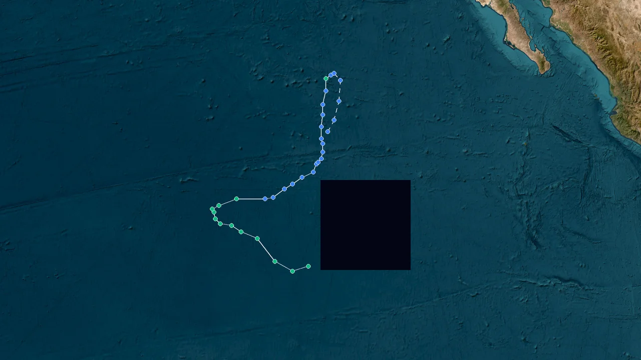
Tropical Depression Odalys (2026)
Formation Time: 20 Sep 2026 01:00 GMT-8
Formation Location: East Pacific(11.4°N, 124.5°W)
Dissipation Time: 27 Sep 2026 13:00 GMT-8
Max Wind Speed: 212 km/h
Min Pressure: 946 hPa

Tropical Depression Marie (2026)
Formation Time: 01 Sep 2026 02:00 GMT-7
Formation Location: East Pacific(13.8°N, 108.9°W)
Dissipation Time: -
Max Wind Speed: 155 km/h
Min Pressure: 972 hPa

Tropical Storm Karina (2026)
Formation Time: 27 Aug 2026 14:00 GMT-7
Formation Location: East Pacific(11.1°N, 111.9°W)
Dissipation Time: -
Max Wind Speed: 230 km/h
Min Pressure: 942 hPa

Tropical Depression Lowell (2026)
Formation Time: 27 Aug 2026 12:00 GMT-9
Formation Location: East Pacific(11.3°N, 133.8°W)
Dissipation Time: 10 Sep 2026 18:00 GMT-9
Max Wind Speed: 259 km/h
Min Pressure: 927 hPa

Tropical Depression Lala (2026)
Formation Time: 13 Aug 2026 05:00 GMT-10
Formation Location: East Pacific(15.2°N, 145.5°W)
Dissipation Time: 27 Aug 2026 23:00 GMT-10
Max Wind Speed: 212 km/h
Min Pressure: 947 hPa

Tropical Depression Genevieve (2026)
Formation Time: 24 Jul 2026 14:00 GMT-7
Formation Location: East Pacific(9.2°N, 101.9°W)
Dissipation Time: 02 Aug 2026 14:00 GMT-7
Max Wind Speed: 259 km/h
Min Pressure: 925 hPa

Tropical Depression Fausto (2026)
Formation Time: 19 Jul 2026 13:00 GMT-8
Formation Location: East Pacific(12.4°N, 112.7°W)
Dissipation Time: 29 Jul 2026 07:00 GMT-8
Max Wind Speed: 166 km/h
Min Pressure: 967 hPa

Extratropical Cyclone Melissa (2025)
Formation Time: 21 Oct 2025 01:00 GMT-5
Formation Location: Atlantic(14.0°N, 70.0°W)
Dissipation Time: 01 Nov 2025 01:00 GMT-5
Max Wind Speed: 302 km/h
Min Pressure: 892 hPa

Tropical Depression Priscilla (2025)
Formation Time: 04 Oct 2025 05:00 GMT-7
Formation Location: East Pacific(15.2°N, 106.3°W)
Dissipation Time: 11 Oct 2025 17:00 GMT-7
Max Wind Speed: 184 km/h
Min Pressure: 954 hPa

Tropical Depression Octave (2025)
Formation Time: 29 Sep 2025 11:00 GMT-7
Formation Location: East Pacific(9.3°N, 112.2°W)
Dissipation Time: 09 Oct 2025 11:00 GMT-7
Max Wind Speed: 148 km/h
Min Pressure: 980 hPa

Extratropical Cyclone Imelda (2025)
Formation Time: 26 Sep 2025 13:00 GMT-5
Formation Location: Atlantic(20.9°N, 74.9°W)
Dissipation Time: 05 Oct 2025 19:00 GMT-5
Max Wind Speed: 148 km/h
Min Pressure: 966 hPa

Extratropical Cyclone Humberto (2025)
Formation Time: 24 Sep 2025 08:00 GMT-4
Formation Location: Atlantic(19.1°N, 53.6°W)
Dissipation Time: 01 Oct 2025 08:00 GMT-4
Max Wind Speed: 259 km/h
Min Pressure: 918 hPa

Tropical Depression Narda (2025)
Formation Time: 21 Sep 2025 11:00 GMT-7
Formation Location: Atlantic(14.4°N, 99.4°W)
Dissipation Time: 30 Sep 2025 17:00 GMT-7
Max Wind Speed: 166 km/h
Min Pressure: 970 hPa

Extratropical Cyclone Gabrielle (2025)
Formation Time: 17 Sep 2025 15:00 GMT-3
Formation Location: Atlantic(19.0°N, 47.7°W)
Dissipation Time: 28 Sep 2025 15:00 GMT-3
Max Wind Speed: 220 km/h
Min Pressure: 944 hPa

Tropical Depression Lorena (2025)
Formation Time: 01 Sep 2025 17:00 GMT-7
Formation Location: East Pacific(16.9°N, 104.8°W)
Dissipation Time: 06 Sep 2025 23:00 GMT-7
Max Wind Speed: 137 km/h
Min Pressure: 981 hPa

Tropical Depression Kiko (2025)
Formation Time: 30 Aug 2025 16:00 GMT-8
Formation Location: East Pacific(14.4°N, 121.1°W)
Dissipation Time: 10 Sep 2025 16:00 GMT-8
Max Wind Speed: 230 km/h
Min Pressure: 945 hPa

Extratropical Cyclone Erin (2025)
Formation Time: 10 Aug 2025 22:00 GMT-2
Formation Location: Atlantic(16.5°N, 23.1°W)
Dissipation Time: 27 Aug 2025 16:00 GMT-2
Max Wind Speed: 259 km/h
Min Pressure: 913 hPa

Tropical Depression Henriette (2025)
Formation Time: 03 Aug 2025 22:00 GMT-8
Formation Location: East Pacific(13.4°N, 117.5°W)
Dissipation Time: 13 Aug 2025 22:00 GMT-8
Max Wind Speed: 137 km/h
Min Pressure: 986 hPa

Extratropical Cyclone Dexter (2025)
Formation Time: 02 Aug 2025 13:00 GMT-5
Formation Location: Atlantic(33.2°N, 75.6°W)
Dissipation Time: 13 Aug 2025 01:00 GMT-5
Max Wind Speed: 130 km/h
Min Pressure: 988 hPa

Tropical Depression Gil (2025)
Formation Time: 30 Jul 2025 16:00 GMT-8
Formation Location: East Pacific(12.5°N, 113.3°W)
Dissipation Time: 04 Aug 2025 16:00 GMT-8
Max Wind Speed: 119 km/h
Min Pressure: 991 hPa
Storm Database Information
StormAtlas maintains one of the most comprehensive tropical cyclone databases available online. Our records cover storms across all major ocean basins including the Western Pacific, Eastern Pacific, Atlantic, Indian Ocean and South Pacific. Data is sourced from official meteorological agencies including JMA, NHC, JTWC and CMA.
Frequently Asked Questions about Storm Atlas
How does the Live Hurricane Tracker get official forecast cones?
StormAtlas integrates real-time data from NOAA's National Hurricane Center (NHC), displaying live forecast track cones, storm surges, and satellite imagery.
When is the Atlantic Hurricane Season?
The Atlantic hurricane season officially runs from June 1 to November 30, with peak activity occurring from mid-August through October.
What is the difference between a Hurricane and a Typhoon?
Both are tropical cyclones; terminology depends on location. Storms in the Atlantic and East Pacific are Hurricanes, Western Pacific storms are Typhoons, while Indian Ocean and South Pacific storms are Cyclones.
Understanding Hurricanes & The Saffir-Simpson Scale
A hurricane is a severe tropical cyclone occurring in the North Atlantic Ocean, Caribbean Sea, Gulf of Mexico, or Eastern/Central Pacific Ocean with sustained winds of 74 mph (64 knots / 119 km/h) or higher. Tracked primarily by the US National Hurricane Center (NHC) and Central Pacific Hurricane Center (CPHC).
Atlantic hurricanes typically originate from African easterly waves between June 1 and November 30. Their paths are steered by the Bermuda-Azores Subtropical High, sea surface temperatures (>26.5°C), and tropospheric vertical wind shear.
Categorized strictly by 1-minute sustained wind velocity measured at standard 10-meter elevation.
Frequently Asked Meteorological Questions
Aligned with official WMO and regional meteorological agency guidance