
Tropical Storm Rachel Live Tracking Map
Local time · Active since 27 Sep 2026 14:00 GMT-7
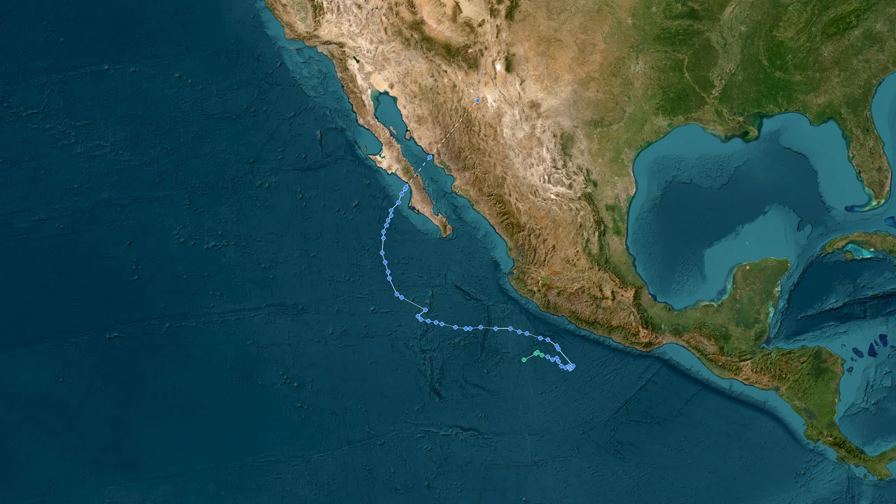
Loading live hurricane tracking map...
Interactive Live Storm Tracker
📊
Estimated Storm Impact Analysis
Real-time analysis of population and infrastructure exposure within the storm's wind field.
👥 Estimated Population at Risk
13.84Mpeople
🏥 Hospitals & Medical Centers
252facilities
🏕️ Evacuation Shelters & Centers
769centers
🏫 Schools & Critical Infrastructure
1846buildings
Basic Information
Peak Category
Tropical Storm
Minimum Pressure
997 hPa
Maximum Wind Speed
90 km/h
Region
Atlantic
Key Events
Formation
27 Sep 2026 14:00 GMT-7
12.6°N, 99.1°W
Frequently Asked Questions about Rachel
Rachel is currently located near 14.5°N, 102.9°W, with maximum sustained winds around 90 km/h (49 kt / 56 mph).
Rachel remains active as a Tropical Storm system, with maximum sustained winds around 90 km/h (49 kt / 56 mph).
Key Meteorological Milestones
Synthesized from official bulletins (NHC/NOAA, JMA, CMA, KMA). Licensed for non-commercial educational & academic research.
🌀
Tropical StormGenesis & Initial Classification
📅 27 Sep 2026 21:00 (27 Sep 2026 14:00 GMT-7)🌐 12.6°N, 99.1°W🏛️ Official
Wind Speed65 km/h (35 kt)
Pressure1005 hPa
⚡
Tropical StormNamed Storm Upgrade (TS)
📅 28 Sep 2026 03:00 (27 Sep 2026 20:00 GMT-7)🌐 12.9°N, 99.8°W🏛️ Official
Wind Speed65 km/h (35 kt)
Pressure1003 hPa
🏆
Tropical StormPeak Lifetime Intensity (LMI)
📅 29 Sep 2026 00:00 (28 Sep 2026 17:00 GMT-7)🌐 14.3°N, 102.5°W🏛️ Official
Wind Speed90 km/h (49 kt)
Pressure997 hPa
📉 Pressure Drop-8 hPa
🌫️
Tropical StormFinal Advisory / Dissipation
📅 29 Sep 2026 03:00 (28 Sep 2026 20:00 GMT-7)🌐 14.5°N, 102.9°W🏛️ Official
Wind Speed90 km/h (49 kt)
Pressure997 hPa
💾Best-Track Scientific Dataset Exporter
🟢 Live Working Track (Updating)Synthesized research-grade meteorological data ready for Excel, Python Pandas, or GIS platforms, compliant with academic citations and multi-agency validation.