
Tropical Storm Iselle Stays Offshore, Fades After Brief Peak
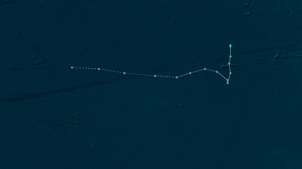
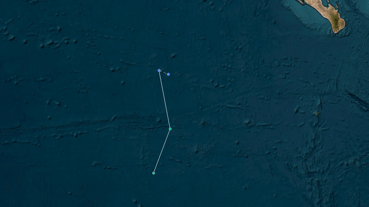
Tropical Storm Iselle stayed offshore in the eastern North Pacific, bringing dangerous surf to Baja California but no direct landfall. The storm formed on August 23, 2026, and strengthened steadily as it moved northwest over open water. Iselle reached its peak operational intensity on August 24–25 at 70 mph, or about 60 kt, with a minimum central pressure of 988 mb. By 0300 UTC on August 27, persistent wind shear, dry air and cooler water had stripped away the storm's deep convection, and Iselle had become a post-tropical cyclone.
Formation Offshore: Iselle Builds Southwest of Baja California
Iselle began as a monitored area of low pressure several days before it received a name. By the morning of August 23, satellite imagery and scatterometer observations showed enough organization for forecasters to upgrade the system to Tropical Storm Iselle.
At 1500 UTC on August 23, the storm was centered near 15.3°N, 114.2°W, about 955 km south-southwest of the southern tip of Baja California. Its maximum sustained winds were 40 kt, or 45 mph, and its estimated minimum central pressure was 1003 mb. The storm was moving west-northwest at about 12 mph. No coastal watches or warnings were in effect.
The upgrade followed a clear improvement in the low-level circulation. An ASCAT-C pass at 0517 UTC had measured winds near 40 kt, although the circulation was not yet fully defined. A later OSCAT pass showed further consolidation, while satellite imagery indicated that deep convection was becoming concentrated over the low-level center. Those observations gave the National Hurricane Center enough evidence to classify the system as a tropical storm.
The initial forecast called for continued strengthening as Iselle moved across warm water. A mid-level ridge north of the storm controlled much of its movement, keeping the cyclone on a generally northwestward path. The ridge later became stronger and helped turn the storm more toward the west-northwest.
By 0300 UTC on August 24, Iselle was near 17.1°N, 115.3°W, approximately 855 km southwest of the southern tip of Baja California. Maximum sustained winds had increased to 50 mph, or roughly 45 kt, while the central pressure had fallen to 999 mb. The storm continued moving northwest at about 12 mph.
The storm's wind field was already broad enough to produce a marine hazard well away from the center. Tropical-storm-force winds extended outward as far as 125 miles, or about 205 km, and the NHC warned that Iselle-generated swell would affect the west coast of the Baja California Peninsula. The forecast emphasized dangerous surf and rip currents rather than a direct wind threat to land.
During the first half of August 24, Iselle's organization improved despite moderate west-northwesterly shear. Infrared satellite imagery showed a core of very deep convection rotating over and north of the center, while a strong convective band extended southward along the eastern side of the circulation.
An AMSR-2 microwave pass at 0903 UTC provided additional evidence of a better-defined inner core. At the same time, subjective Dvorak analysis from the Tropical Analysis and Forecast Branch supported a substantial increase in intensity, while objective satellite estimates ranged from 50 to 59 kt. The NHC therefore set the initial intensity at 55 kt for the 1500 UTC advisory period.
That sequence is important to the storm's history because Iselle's strengthening was not simply a steady rise in wind speed. The cyclone was organizing internally while the surrounding environment remained somewhat hostile. The increasingly coherent core temporarily overcame moderate shear, allowing the storm to intensify rapidly during a relatively short window.
By the evening of August 24, Iselle had reached the strongest part of its life cycle.
Peak Intensity: Iselle Reaches 70 MPH Near Hurricane Strength
At 2100 UTC on August 24, Iselle reached 60 kt, or 70 mph, with a minimum central pressure of 988 mb. The center was near 19.2°N, 118.0°W, roughly 935 km west-southwest of the southern tip of Baja California.
The storm was close to hurricane strength, but it never crossed the operational threshold of 64 kt. The NHC's advisory products consistently placed the peak at 60 kt, with gusts reaching 75 kt.
Three hours later, at 0300 UTC on August 25, the intensity remained 60 kt, or 70 mph, and the central pressure remained 988 mb. The center had moved to approximately 20.1°N, 118.6°W, with a northwestward motion of about 13 kt.
The 0300 UTC position marked the storm's closest approach to its peak structural organization. Satellite imagery showed an established curved convective band, with cloud tops colder than minus 75°C in the strongest thunderstorms. An ASCAT-B pass measured winds of approximately 53–56 kt, while Dvorak estimates ranged from 51 to 63 kt. The available observations supported maintaining the 60-kt intensity.
Iselle remained at 60 kt through the 0900 and 1500 UTC advisory periods on August 25. At 1500 UTC, the center was near 20.9°N, 121.1°W, approximately 1,175 km west of the southern tip of Baja California. The minimum central pressure was still 988 mb, and the storm's tropical-storm-force wind field extended as far as 335 km from the center.
The storm's peak therefore lasted longer than a single advisory. From the evening of August 24 through the afternoon of August 25, operational analyses kept Iselle at 60 kt. That period produced the storm's lowest pressure and strongest sustained winds.
Yet the satellite presentation was already showing signs of structural stress.
At 1500 UTC on August 25, a GCOM-AMSR2 microwave pass showed that the low-level center had become displaced southwest of the mid-level circulation. The deepest convection was no longer concentrated directly over the surface center. Instead, a large convective mass had developed to the northeast, leaving the low-level circulation increasingly separated from the storm's upper structure.
That displacement became the defining feature of the weakening phase. A tropical cyclone can tolerate some vertical shear, but sustained separation between its low-level and mid-level centers makes it increasingly difficult for deep convection to remain over the surface circulation.
Iselle was not the only tropical cyclone in the area during this period. A smaller system to the south also developed into Tropical Storm Julio on August 25. Julio formed near 15.7°N, 119.8°W with maximum sustained winds of 45 mph, or 40 kt, and moved north-northeastward. The NHC noted that Julio was becoming increasingly influenced by Iselle's outer circulation and was forecast to be absorbed.
By 1500 UTC, Julio had strengthened slightly to 50 mph, or about 45 kt, near 18.0°N, 118.9°W. Its circulation was moving rapidly north-northeastward toward Iselle. The NHC forecast that Julio would be absorbed by Iselle later that day.
The interaction did not produce a second period of strengthening for Iselle. Instead, Julio's small circulation became part of the broader circulation around the stronger storm and subsequently dissipated as a separate tropical cyclone. The NHC issued Julio's final advisory at 2100 UTC on August 25, when its remnants were near 21.0°N, 119.5°W, with 45-mph winds and a pressure of 1003 mb. The remnants were moving toward Iselle's circulation.
The proximity of Julio added another structural feature to an already complicated environment. Iselle was simultaneously experiencing increasing shear and losing its compact inner core while the smaller circulation of Julio moved into its broader circulation. The result was a storm that remained a 60-kt tropical cyclone for much of August 25 but was already entering a clear weakening phase.
Shear Takes Control: Iselle's Core Breaks Apart
The transition from a well-organized tropical storm to a weakening circulation happened quickly after the peak.
By the afternoon of August 25, the low-level circulation had become further detached from the mid-level center. Deep convection was concentrated well away from the center, near the older mid-level circulation. A recent ASCAT scatterometer pass showed peak winds around 45 kt, leading the NHC to lower the operational intensity to 50 kt at 2100 UTC.
At that stage, the storm's weakening was being driven by three linked environmental problems: persistent wind shear, increasingly dry air near the core, and progressively cooler water.
Wind shear was the most immediate structural problem. The low-level center could no longer remain directly underneath the mid-level circulation. As the two centers separated, thunderstorms were pushed away from the surface center. Without persistent deep convection over the low-level circulation, the cyclone lost the concentrated heat release that had supported its earlier strengthening.
The NHC's August 25 discussion described the low-level circulation as becoming increasingly detached from the mid-level center. Water-vapor imagery also showed dry air intruding far into the cyclone's core. Those observations provided a direct satellite signature of the storm's deterioration.
The change was reflected in the wind estimates. At 1500 UTC on August 25, Iselle still had 60-kt winds. By 2100 UTC, the estimate had fallen to 50 kt. The central pressure had risen from 988 mb to 994 mb. The reduction in wind speed and rise in pressure occurred as the organized convection moved away from the low-level center.
The weakening continued into August 26.
At 0900 UTC, Iselle had fallen to approximately 50 mph, or 45 kt, near 21.8°N, 123.5°W. The pressure had risen to 996 mb. The storm was moving west-northwestward across the open Pacific, farther from the Baja California Peninsula.
By 1500 UTC, the circulation was more exposed and the deep convection had shifted well northeast of the low-level center. Maximum sustained winds had dropped to approximately 45 mph, or 40 kt. The storm no longer had the compact structure seen during its peak.
At 2100 UTC, Iselle was down to 35 kt, or about 40 mph. Scatterometer observations supported the lower intensity estimate, with a measured peak wind near 34 kt. The NHC forecast the storm to lose its tropical characteristics as the remaining convection disappeared.
The deterioration was therefore not caused by one abrupt event. The storm first lost vertical alignment, then saw its deepest convection displaced from the surface center, while dry air and cooler water further reduced the environment's ability to support tropical convection.
The interaction with Julio had also ended as a distinct feature by this point. Julio's remnants were moving into Iselle's broader circulation, and Julio was no longer maintained as a separate tropical cyclone after its final advisory on August 25.
For Iselle, the more important signal was the loss of its own inner-core organization. Once the low-level center became exposed and the mid-level circulation shifted away, the storm's remaining energy was spread over a much larger area rather than concentrated in a strong tropical core.
That structural change explains why the storm could fall from 60 kt to 35 kt in roughly a day without making landfall or encountering a dramatic change in its track.
Coastal Effects: Swell Reached Baja Without a Landfall
Iselle's principal coastal hazard was surf.
From the first advisory, the NHC warned that swells generated by the storm would affect the west coast of the Baja California Peninsula. At formation, the center was nearly 1,000 km offshore, so direct tropical-storm winds were not a coastal concern. The expanding wave field, however, could travel far beyond the circulation itself.
As Iselle strengthened, the surf hazard increased. On August 25, when the storm had 70-mph sustained winds and a 988-mb central pressure, the NHC reported that Iselle-generated swells were already affecting the west coast of Baja California. Those swells were expected to continue for several days and were capable of producing life-threatening surf and rip-current conditions.
There were no coastal watches or warnings in effect for Iselle during its peak. The center remained well offshore, and the storm's strongest winds stayed over the Pacific. That separation kept the direct wind threat away from populated coastal areas.
The distinction between wind and swell is important in assessing a storm that remains offshore. A tropical cyclone does not need to cross the coastline to produce hazardous ocean conditions. Large areas of persistent winds can transfer energy into the sea, generating swell that travels toward distant beaches even as the storm itself moves away.
Iselle's broad wind field contributed to that process. At 1500 UTC on August 25, tropical-storm-force winds extended as far as 205 miles, or about 335 km, from the center. The strongest winds were concentrated within a smaller part of that field, but the larger circulation still generated a substantial wave environment.
The storm's northwestward track also helped keep the circulation away from the Baja California Peninsula. As Iselle moved farther west, its center continued to separate from Mexico while its swell propagated toward the coastline.
By August 26, the storm was weakening quickly, but the coastal surf hazard did not disappear at the same rate as the wind speed. Waves generated while Iselle was stronger continued to move outward after the cyclone's core had weakened.
The NHC continued to mention the Baja California surf hazard in its later advisories while Iselle weakened. This reflected the different time scales of tropical-cyclone winds and ocean swell: the cyclone's central circulation can deteriorate within hours while previously generated waves continue moving toward shore.
There was therefore no direct landfall damage associated with Iselle. Its measurable coastal effect was primarily marine, with dangerous surf and rip-current conditions along parts of the west coast of Baja California.
The storm's offshore track also kept its strongest wind field away from coastal infrastructure. At no point did the NHC issue a tropical-storm or hurricane warning for land in connection with Iselle. The official advisories consistently identified surf as the main land-area hazard.
Final Dissipation: Iselle Fades to a Post-Tropical Remnant Low
The final stage of Iselle's life cycle came on August 27.
At 0300 UTC on August 27, the NHC classified Iselle as a post-tropical cyclone. Its center was near 23.0°N, 125.9°W, and maximum sustained winds had fallen to 30 kt, or 35 mph. The estimated minimum central pressure was 1002 mb.
The transition marked the end of Iselle as a tropical cyclone. The system no longer had the organized deep convection and tropical structure needed to remain classified as a tropical storm.
The weakening had followed a clear sequence. Iselle formed with 40-kt winds on August 23, strengthened through August 24, reached 60 kt and 988 mb late that day, maintained that peak through much of August 25, and then weakened sharply as its low-level and mid-level circulations separated.
The forecast advisory issued during the peak already showed the likely end of the storm's tropical phase. At 1500 UTC on August 25, the NHC forecast Iselle to weaken to 35 kt by August 27 and become a post-tropical remnant low soon afterward. The extended forecast called for dissipation by August 29.
The actual transition followed that general trajectory. By the time the system became post-tropical, the circulation was far into the open Pacific and had lost the organized convective structure that had supported its peak intensity.
Iselle's final phase also illustrates why central pressure and wind speed must be interpreted alongside satellite structure. A storm can retain a recognizable circulation after its tropical convection has collapsed, but the remaining low is no longer functioning as a vertically aligned tropical cyclone.
The final operational record therefore closes with a weakening remnant circulation rather than a landfalling system. Iselle remained over open water through its tropical life cycle, while the coastal effects were limited mainly to swell and surf along Baja California.
Default Best Recommendation
The clearest way to assess Iselle's 2026 life cycle is to follow the six-hourly operational record rather than isolated peak-intensity headlines. The advisory sequence shows the storm's development from 40 kt at formation, through 55 kt on August 24, to 60 kt and 988 mb at peak intensity, followed by a rapid decline to 30 kt at the post-tropical transition.
For intensity comparisons, the paired units are useful: 40 kt is approximately 45 mph, 55 kt is approximately 65 mph, and 60 kt is approximately 70 mph. Using one primary unit consistently avoids the impression that separate advisories were reporting conflicting wind speeds.
The storm's structural history is equally important. Iselle did not simply weaken because its winds fell after reaching 70 mph. The low-level center became displaced southwest of the mid-level circulation, deep convection shifted away from the center, dry air entered the core, and cooler water further reduced the storm's ability to sustain convection.
Julio's short-lived circulation also belongs in the chronology. Julio became a tropical storm on August 25, reached 50 mph, and then dissipated as a separate tropical cyclone while moving into Iselle's broader circulation.
FAQ
- When did Tropical Storm Iselle form in 2026?
Iselle was upgraded to a tropical storm at 1500 UTC on August 23, 2026. At that time, the center was near 15.3°N, 114.2°W, and maximum sustained winds were 40 kt, or 45 mph.
- Where did Iselle form?
Iselle formed in the eastern North Pacific, approximately 955 km south-southwest of the southern tip of Baja California. It remained offshore throughout its tropical-cyclone life cycle.
- What was Iselle's strongest wind speed?
Iselle's maximum sustained wind speed was 60 kt, or 70 mph. The storm maintained that intensity through several advisory periods on August 24 and August 25.
- Did Iselle become a hurricane?
No. Iselle reached 60 kt, or 70 mph, but hurricane classification in the eastern North Pacific begins at 64 kt. The storm therefore remained a tropical storm throughout its strongest phase.
- What was Iselle's lowest central pressure?
The lowest operationally estimated central pressure was 988 mb. It was recorded during the storm's peak-intensity period on August 24–25.
- When did Iselle reach peak intensity?
Iselle reached 60 kt and 988 mb at 2100 UTC on August 24. It remained at 60 kt through the 0300, 0900 and 1500 UTC advisories on August 25.
- Why did Iselle weaken after reaching 70 mph?
Wind shear, dry air and cooler water all contributed to the decline, but the key structural change was the separation of the circulation centers. The low-level center became displaced southwest of the mid-level circulation, leaving deep convection away from the surface center. As that displacement increased, Iselle lost the organized inner-core convection needed to maintain its strength.
- What happened to Iselle's low-level center?
The low-level center progressively detached from the mid-level center. By August 25, satellite imagery showed the low-level circulation displaced southwest of the mid-level circulation, while the deepest thunderstorms remained well northeast of the surface center.
- Did dry air contribute to Iselle's weakening?
Yes. Water-vapor imagery showed dry air intruding into the core as Iselle weakened. The dry-air intrusion reduced the persistence of deep convection and added to the effects of vertical wind shear and cooler water.
- How did cooler water affect Iselle?
As Iselle moved west-northwestward, it encountered progressively cooler water. The declining sea-surface temperatures reduced the oceanic energy available to support deep tropical convection, reinforcing the weakening caused by wind shear and dry-air entrainment.
- What happened to Tropical Storm Julio?
Julio formed as a separate tropical storm on August 25 near 15.7°N, 119.8°W, with winds of 45 mph. It strengthened to 50 mph later that day, but the NHC forecast that it would be absorbed by the larger Iselle circulation. Julio's final advisory was issued at 2100 UTC on August 25, when its remnants were near 21.0°N, 119.5°W.
- Did Julio strengthen Iselle?
The official record does not attribute Iselle's peak intensity to Julio. Iselle had already reached 60 kt before Julio's final dissipation. The important interaction was that Julio's smaller circulation became increasingly influenced by Iselle and subsequently moved into Iselle's broader circulation.
- Did Iselle make landfall?
No. Iselle remained offshore. The main coastal hazard identified in the official advisories was swell affecting the west coast of the Baja California Peninsula.
- What was the main coastal hazard from Iselle?
The primary hazard was dangerous surf and rip currents generated by Iselle's swell. The NHC reported that those swells were affecting the west coast of Baja California while the storm remained far offshore.
- Were tropical-storm warnings issued for Baja California?
No coastal watches or warnings were in effect during Iselle's peak. The storm remained far enough offshore that the official land-area hazard focused on surf rather than tropical-storm-force winds.
- How far did Iselle's tropical-storm-force winds extend?
At 1500 UTC on August 25, tropical-storm-force winds extended outward as far as 205 miles, or 335 km, from the center. The wind field was not uniform, with different radii in each quadrant.
- What was Iselle's position at peak intensity?
At 1500 UTC on August 25, Iselle's center was near 20.9°N, 121.1°W, approximately 1,175 km west of the southern tip of Baja California.
- What was Iselle's pressure when it became post-tropical?
When the NHC classified Iselle as post-tropical at 0300 UTC on August 27, the estimated minimum central pressure was 1002 mb, with maximum sustained winds of 30 kt, or 35 mph.
- When did Iselle become post-tropical?
Iselle became a post-tropical cyclone at 0300 UTC on August 27, 2026. Its center was near 23.0°N, 125.9°W at the time.
- When did the National Hurricane Center stop issuing advisories for Iselle?
The NHC issued its final advisory for Iselle at 0300 UTC on August 27, when the system had become a post-tropical remnant low.
- How long did Iselle remain a tropical storm?
Iselle was classified as a tropical storm from August 23 until its post-tropical transition at 0300 UTC on August 27. Its strongest period occurred during August 24–25, when it reached 60 kt.
- Was Iselle stronger than Julio?
Yes. Iselle peaked at 60 kt, or 70 mph, while Julio reached 50 mph, or approximately 45 kt. Julio also had a much shorter life as a named tropical cyclone and dissipated as a separate system on August 25.
- What satellite observations helped track Iselle?
Forecasters used several satellite-based tools, including AMSR-2 microwave imagery, ASCAT scatterometer measurements and Dvorak intensity estimates. These observations helped identify the improving inner core during August 24 and the increasingly displaced circulation during the weakening phase.
- Why was Iselle's peak intensity short-lived?
The storm entered its peak with a relatively organized convective core, but persistent westerly shear soon displaced the low-level center from the mid-level circulation. Dry air entered the core and cooler water reduced environmental support. The combination caused deep convection to retreat from the center and the wind field to weaken rapidly.
- What is the key scientific feature of Iselle's weakening phase?
The defining structural feature was vertical separation between the low-level and mid-level circulations. Once the low-level center became displaced southwest of the mid-level circulation, the strongest thunderstorms no longer sat over the surface center. That loss of alignment marked the transition from a strengthening tropical storm to a weakening, sheared system.
Conclusion: Iselle's Record Ends Over the Open Pacific
Iselle's 2026 record follows a compact tropical-cyclone life cycle: it formed at 40 kt (45 mph) on August 23, strengthened to 55 kt (65 mph) on August 24, reached 60 kt (70 mph) and 988 mb late on August 24, held that peak through much of August 25, and then weakened as wind shear separated its low-level and mid-level circulations. Julio developed nearby and was absorbed into Iselle's broader circulation as Iselle entered its weakening phase. By 0300 UTC on August 27, Iselle had fallen to 30 kt (35 mph) and was classified as a post-tropical cyclone over the open eastern North Pacific.
Source: National Hurricane Center advisory archive.