

Typhoon Saudel’s Three Landfalls Reshaped Southeast China
language: "en"
season: 2026
Typhoon Saudel became a major Western Pacific weather event in late August and early September 2026, combining rapid intensification offshore with an unusually complicated landfall sequence across East Asia. Its documented impacts stretched from the Northern Mariana Islands and the Philippines to Okinawa, Amami, Zhejiang, Fujian, Jiangxi and Hunan, with the most serious later losses linked to rainfall-triggered flooding and landslides in inland China. Saudel entered the Philippine Area of Responsibility as Typhoon Obet on August 24, struck Zhejiang twice on August 28, redeveloped over the South China Sea, and made a third Chinese landfall in Fujian on September 3. By September 10, rain-triggered landslides in Jiangxi's Suichuan County had killed 16 people, while more than 18,000 residents had been evacuated from the county.
Offshore intensification near the Marianas: Saudel builds a powerful core
Saudel strengthened into a powerful typhoon east of the Philippines, reaching 125 mph maximum sustained winds in U.S. National Weather Service advisories on August 23-24 while typhoon-force winds extended as far as 90 miles from the center.
National Weather Service
The first defining phase of Saudel occurred far from the eventual Chinese disaster zone.
The system strengthened rapidly southeast of Agrihan in the Northern Mariana Islands before turning toward the west-northwest. The U.S. National Weather Service identified Saudel as Typhoon 17W and documented a rapid intensification episode on August 22. By August 23, the cyclone had reached 125 mph maximum sustained winds, with its center positioned well east of the Philippine archipelago.
National Weather Service
At 2100 UTC on August 24, the NWS placed Saudel near 23.5°N, 137.2°E, still far from Okinawa and the Chinese coast, with maximum sustained winds of 125 mph and west-northwest movement at 17 mph. The next advisory maintained 125 mph winds as Saudel continued toward Okinawa.
National Weather Service
The structure was already large enough to create hazards beyond the eyewall. The August 24 advisory placed typhoon-force winds out to roughly 90 miles and tropical-storm-force winds out to approximately 195 miles. That wind-field size matters operationally because an island can experience severe weather even when the center passes offshore.
National Weather Service
PAGASA later documented the Philippine phase from another perspective. Saudel entered the Philippine Area of Responsibility on August 24 and received the local name Obet. PAGASA's monthly August assessment lists Obet among five tropical cyclones that entered or developed within the PAR during the month.
At the time of entry, Saudel remained well offshore. PAGASA's local bulletin placed the center approximately 1,430 km east-northeast of extreme Northern Luzon, with maximum sustained winds of 165 km/h, gusts reaching 205 km/h and a central pressure of 945 hPa.
Iloilo City DRRM
The Philippine impact was therefore not a direct typhoon landfall.
Instead, Saudel interacted with the Southwest Monsoon. PAGASA's August climate assessment states that Obet and other tropical cyclones enhanced the Southwest Monsoon, contributing to episodes of heavy rainfall that triggered flooding and rain-induced landslides in western and Central Luzon and parts of Western Visayas. PAGASA also cautioned that several tropical cyclones and the monsoon were involved during the period, so individual rainfall losses cannot automatically be assigned to Saudel alone.
That distinction is important in a retrospective report. A cyclone can influence a country without making landfall, especially when it strengthens or redirects a regional moisture conveyor.
Saudel’s peak structure and the limits of a single intensity number
The available operational records show that Saudel's maximum strength occurred over open water rather than at any of its Chinese landfalls.
The IBTrACS-derived record maintained by Japan's Digital Typhoon database shows Saudel at 115 kt with a central pressure of 956 hPa in provisional best-track data on August 22, with subsequent records continuing to document a very strong typhoon.
Agora
The NWS operational advisories provide another useful benchmark. They reported 125 mph maximum sustained winds on August 23 and again on August 24 before gradual weakening began.
National Weather Service
These datasets use different agencies, analysis times and intensity conventions. They should not be mixed as though every number represents the same observation. The safest interpretation is that Saudel became a high-end typhoon over the Philippine Sea before approaching Japan, then weakened and reorganized as it crossed the East China Sea and repeatedly interacted with land and warm coastal waters.
| :: | :---: |
Benchmark Observed or reported value Interpretation
NWS peak operational wind 125 mph About 201 km/h; major typhoon intensity
NWS typhoon-wind radius Up to 90 miles Broad damaging-wind footprint
PAGASA PAR entry wind 165 km/h Strong typhoon at Philippine monitoring boundary
PAGASA PAR-entry gusts 205 km/h Severe offshore wind hazard
PAGASA PAR-entry pressure 945 hPa Deep tropical-cyclone core
Japan-sector reported wind Up to 144 km/h in impact areas Strong winds affecting Okinawa and Amami
Amami 24-hour rainfall More than 230 mm Significant landslide and flood loading
Zhejiang landfall wind 35 m/s, about 126 km/h Typhoon-force coastal landfall
Zhejiang landfall pressure 975 hPa Weaker than offshore peak
Fujian landfall wind About 23 m/s Tropical-storm-force landfall
Fuding rainfall, Sept. 1 417.8 mm Extreme local rainfall accumulation
Putian 24-hour rainfall 416.5 mm Extreme flood-producing rainfall
Suichuan evacuation More than 18,000 Inland emergency relocation
Suichuan deaths by Sept. 10 16 Confirmed later landslide toll
The matrix combines measurements from different operational and disaster-monitoring systems, so it should be read as a cross-agency benchmark, not as a single homogeneous observation series. The intensity values are especially sensitive to agency methodology, averaging period and observation time.
National Weather Service
Saudel's early life therefore established the first major feature of the storm: its greatest wind intensity was separated geographically and chronologically from its greatest human consequences.
That separation became even clearer after Japan.
Okinawa and Amami passage: Powerful winds meet island terrain
Saudel brought winds of up to about 144 km/h and more than 230 mm of 24-hour rain to parts of southwestern Japan, while more than 150 flights were canceled at Naha and over 30,000 homes lost power in Kagoshima Prefecture.
AP News
By August 25, Saudel was moving toward Okinawa while still carrying typhoon-force winds. The storm's forward motion slowed relative to its earlier movement, increasing the period during which the outer circulation could affect the islands.
The Japan Meteorological Agency and local reporting focused on several simultaneous threats: destructive winds, high waves, heavy rain, landslides and flooding in low-lying areas.
The physical geography of the Ryukyu and Amami islands amplified those risks. Mountainous terrain concentrates runoff quickly, while narrow coastal plains can experience rapid inundation when intense rain falls faster than drainage systems can remove it.
AP reporting documented wind speeds reaching about 144 km/h and more than 23 centimeters of rain in 24 hours in the Amami region. The Japan Meteorological Agency issued landslide-related warnings as the system moved toward the East China Sea.
AP News
The storm also caused substantial disruption to aviation and electricity.
More than 150 flights through Okinawa's Naha Airport were canceled, while more than 30,000 homes in Kagoshima Prefecture lost power. Two elderly women sustained minor injuries, one in Okinawa and another on Amami Oshima.
AP News
The marine environment presented another hazard. Forecasts for the Okinawa and Amami region called for very high waves, with offshore wave heights reaching approximately 11 meters around Okinawa and 10 meters near Amami in the strongest conditions. Rainfall forecasts reached about 170 mm in Okinawa and 250 mm in Amami over a 24-hour period in the cited forecast period.
Berita.Jepang.org
The Japanese impacts demonstrate an important difference between maximum sustained wind and total storm exposure.
A cyclone's center may pass dozens or hundreds of kilometers from a populated island, yet the combination of outer rainbands, pressure gradients, storm-relative winds and ocean waves can produce serious disruption. Aviation schedules can be affected before damaging winds reach an airport. Electricity failures can spread across a large service area. Landslide warnings can remain in force after the strongest gusts have passed.
Saudel's Japanese passage also represented the beginning of the storm's transition toward a more complicated landfall pattern.
The system was no longer moving across a simple open-ocean environment. It was entering a region where interactions among land, sea, terrain, monsoonal moisture and changing steering currents would shape the next stage.
The East China Sea became the bridge between the powerful oceanic typhoon and the multi-landfall cyclone that followed.
Two Zhejiang landfalls on August 28: Saudel changes from wind threat to compound coastal hazard
Saudel made two landfalls in Zhejiang on August 28, first near Yuhuan and then near Wenzhou, with reported landfall winds of 35 m/s and a central pressure of 975 hPa.
South China Morning Post
The first Chinese landfall occurred near Yuhuan in Taizhou at approximately 8:05 a.m. local time on August 28. A second landfall followed near Wenzhou at about 9:10 a.m.
South China Morning Post
That close succession was one of the most unusual features of the storm's track.
Saudel did not simply cross the coast once and dissipate. Its circulation and center interacted with the Zhejiang coastline in a way that produced two distinct landfall points within a short period. The result was an extended period of hazardous weather across a densely populated coastal region.
At landfall, reported maximum sustained winds were around 35 m/s, equivalent to approximately 126 km/h, while the central pressure was about 975 hPa. Those values were materially weaker than the cyclone's strongest offshore phase.
ICIS
Yet lower central intensity did not mean lower regional risk.
Zhejiang combines high population density, major ports, industrial infrastructure, extensive transport networks and low-lying coastal communities. Strong winds and heavy rain can therefore create disruption even when the storm is well below its maximum lifetime intensity.
Authorities responded with large-scale evacuations and transportation restrictions.
Wenzhou evacuated more than 820,000 residents, while Taizhou identified approximately 52,000 people for relocation. Ferry routes were suspended, rail services were disrupted and coastal operations were restricted as the storm approached.
ICIS
The marine economy also felt the storm.
Ports around Shanghai, Ningbo and Zhoushan experienced weather-related restrictions, affecting vessel movements and cargo schedules. The interruption extended beyond the immediate landfall zone because port operations depend on wind, waves, visibility, pilotage conditions and safe access to channels.
ICIS
This was a compound coastal hazard rather than a pure wind event.
Strong onshore flow can raise water levels along exposed coastlines. Heavy rainfall can simultaneously increase river discharge and overwhelm urban drainage. If elevated coastal water levels coincide with high river stages, drainage efficiency falls and floodwater can remain trapped for longer.
Zhejiang authorities also highlighted the role of unusually high tides during the storm period. The interaction of strong winds, high waves, heavy rainfall and tidal conditions increased the potential for coastal flooding.
South China Morning Post
The storm's consequences therefore depended on several variables at once:
Wind speed and direction
Rainfall intensity and duration
Coastal water level
Tidal phase
River discharge
Drainage capacity
Local elevation
Population exposure
Transport and industrial vulnerability
This explains why a retrospective based only on minimum central pressure would miss much of Saudel's actual impact.
Why the first Chinese landfall did not end the storm
Saudel weakened over land, but its circulation did not simply disappear.
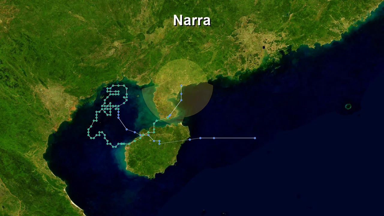
The remnants subsequently moved back over water, where warm sea-surface temperatures and residual atmospheric moisture allowed the system to reorganize. By early September, the cyclone had redeveloped over the South China Sea.
WeatherNews reported that JMA observations on September 1 placed Saudel near 19.8°N, 113.9°E south of Hainan, with tropical-storm intensity, a central pressure of 994 hPa and maximum sustained winds of 35 kt.
Weathernews
This redevelopment created the storm's second life cycle.
The system's track also became slower and more uncertain. Forecast guidance showed the circulation moving east-northeastward before slowing near the Taiwan Strait, with uncertainty expanding as the steering pattern weakened.
Weathernews
That slow evolution mattered because rainfall damage depends strongly on residence time.
A storm that moves quickly can produce very intense rainfall but may limit accumulation over any one location. A slower circulation can repeatedly move tropical moisture over the same catchments. When that occurs over mountains or saturated soils, the hydrological response can become much more severe.
Saudel was moving into exactly that type of environment.
Redevelopment over the South China Sea: The storm returns with a new hazard profile
Saudel redeveloped over the South China Sea after its Zhejiang crossing, reaching tropical-storm strength again near 19.8°N, 113.9°E on September 1 with 35-kt winds, while its slow movement increased the risk of prolonged rainfall across southern and southeastern China.
Weathernews
The redevelopment phase is central to understanding why Saudel produced three Chinese landfalls rather than one.
After the first Zhejiang crossing, the system's circulation remained sufficiently organized to survive the land interaction. It later emerged over the South China Sea, where the warm ocean supplied renewed energy and moisture.
The storm's second phase was weaker than its earlier peak, but meteorological intensity and hydrological danger began to diverge.
By September 1, WeatherNews reported a JMA analysis of 994 hPa central pressure, 35-kt sustained winds and 50-kt gusts. The system was moving east-northeast at approximately 20 km/h.
Weathernews
Forecasts then showed the forward motion decreasing sharply. The predicted track moved toward the Taiwan Strait, where the system could become nearly stationary before weakening. The expanding forecast uncertainty reflected the difficulty of determining the steering flow around a reorganizing tropical cyclone.
Weathernews
The atmosphere around Saudel was also changing.
Cold air interacting with the tropical circulation helped maintain heavy rainfall across Fujian. Fujian government reporting stated that the combination of Saudel and cold air brought torrential rain to areas including Ningde, Fuding, Fu'an and Zherong.
Fujian Government
This interaction is meteorologically important.
Tropical cyclones carry deep reservoirs of warm, humid air. When that moisture encounters a cooler air mass, large-scale ascent can intensify rainfall. Terrain then adds another mechanism: moist air forced upward over mountains cools, condenses and releases precipitation efficiently.
The resulting rain can remain severe even while the cyclone's maximum sustained wind decreases.
That is what the Saudel record shows.
The Fujian phase was therefore not simply a weaker repeat of Zhejiang. It represented a shift in the dominant hazard from destructive wind toward extreme rainfall and flooding.
Fujian rainfall becomes the defining physical signal
Fuding recorded 417.8 mm of rain in one town on September 1, according to Fujian government reporting. Floodwater in some townships reached approximately first-floor height, roads were inundated and emergency crews carried out door-to-door checks in high-risk areas.
Fujian Government
Other reporting placed 24-hour rainfall in Putian at 416.5 mm, with surrounding villages exceeding 500 mm during the same period.
Those totals are large enough to overwhelm ordinary drainage systems even without exceptional wind.
Flooding subsequently expanded beyond isolated urban waterlogging.
Rivers rose rapidly, roads became impassable and rescue crews moved residents from inundated areas. In one Fujian incident, responders rescued residents from deep floodwater after the storm's rainfall overwhelmed local drainage and river systems.
The emergency response was correspondingly broad.
Fujian raised its flood-control response to Level II on September 2. Work, production, classes and market activities were suspended in affected areas, while emergency teams cleared roads, drained floodwater and evacuated residents from high-risk locations.
Fujian Government
More than 83,000 people were reported evacuated in Fujian during the renewed storm emergency, while the wider regional evacuation count reached much higher levels. The Guardian, citing local authorities and reporting, put Fujian's high-risk evacuation figure at almost 600,000 during the broader rainfall emergency.
Different reports use different cut-off times and definitions for "evacuated," so these figures should not be added together as though they represent one synchronized total.
The same caution applies to affected populations.
The Asian Disaster Reduction Center reported approximately 128,500 people affected in Jiangxi and about 8,700 evacuated at an earlier reporting stage, while later reporting documented more than 18,000 evacuated from Suichuan County alone. The later figure reflects a subsequent stage of the disaster.
This chronology matters.
Disaster numbers often increase after the storm center has moved away because emergency agencies need time to survey isolated communities, locate missing people, confirm fatalities and identify additional evacuation requirements.
Saudel's rainfall footprint therefore expanded after its operational classification weakened.
The storm's third Chinese landfall became the next stage in that process.
Fujian landfall and the inland landslide crisis: Saudel outlives its own wind threat
Saudel made its third Chinese landfall near Gulei in Zhangpu County, Fujian, at about 6:30 a.m. on September 3 as a tropical storm, while extreme rainfall continued to drive flooding and landslides farther inland.
ICIS
The third landfall was geographically and physically different from the Zhejiang events.
ICIS, citing China's National Meteorological Center, reported that Saudel reached the coast of Gulei in Zhangpu at approximately 06:30 local time on September 3 as a tropical storm. It was the third Chinese landfall after the two Zhejiang crossings on August 28.
ICIS
By this stage, the cyclone was no longer near its lifetime wind maximum.
That distinction is essential.
A tropical cyclone can weaken in terms of central pressure and maximum sustained wind while maintaining a large moisture field. Once the circulation interacts with terrain and other weather systems, rainfall can become more important than wind.
Fujian's official response reflected that change.
The province had already raised its flood-control response to Level II because of torrential rainfall affecting Ningde and nearby areas. Roads flooded, trees were uprooted and rivers rose rapidly. In some Fuding communities, water reached first-floor height.
Fujian Government
Putian experienced particularly severe flooding. The Guardian reported that 416.5 mm of rain fell in 24 hours between Thursday and Friday, while surrounding villages exceeded 500 mm. More than 1,260 people reportedly required rescue in Putian after a river embankment collapsed and flooding affected homes.
In Wenzhou, Zhejiang, more than 2,500 teachers and students became trapped in a school compound after flash flooding affected low-lying areas. Rescue teams used drones to deliver food and drinking water.
The geography of the rainfall footprint was now much larger than the immediate storm center.
Zhejiang, Fujian, Jiangxi and Hunan are connected by regional mountain systems and river basins. Moisture arriving from the tropical cyclone can therefore produce impacts far inland, where the storm itself is no longer identifiable as a compact tropical vortex.
That is precisely what happened in Jiangxi.
Suichuan becomes the center of the human-impact record
The most serious later losses occurred in Suichuan County, Jiangxi.
By September 10, searchers had recovered another body, bringing the documented death toll from rain-triggered landslides in the county to 16. Thirteen deaths occurred in Gaoping, two in Zuo'an and one in Tanghu. More than 18,000 people had been evacuated from Suichuan County.
GB Code
The sequence began earlier.
On September 5, a mudslide in Suichuan killed people and damaged homes after several days of heavy rainfall associated with Saudel. Initial reports identified three deaths and nine missing people. More than 5,300 residents were relocated at that stage.
AP News
The death toll then increased as rescue and recovery teams searched damaged areas.
This progression illustrates why early casualty figures should not be treated as final storm totals. Landslides can isolate villages, block roads and bury structures, delaying access and victim identification.
Jiangxi's position inland from Fujian and Zhejiang also shows how storm impacts can migrate geographically.
Saudel's moisture did not stop at the coastline.
The same rainfall system that produced flooding in Fujian continued to affect the upland terrain of Jiangxi. There, saturated soil and steep slopes converted rainfall into a geological hazard.
In neighboring Hunan, two additional deaths were reported following heavy rain associated with the typhoon, although the available reporting did not provide the same level of causal detail for those fatalities.
GB Code
The distinction between direct and indirect storm effects is scientifically important.
A person does not need to be exposed to typhoon-force winds to be killed by a tropical cyclone. Rainfall-induced landslides, river floods, debris flows and infrastructure failures can occur hundreds of kilometers from the cyclone center.
The Saudel disaster demonstrates that principle clearly.
The storm's operational end was not the disaster's physical end
By September 3, Saudel had weakened sufficiently that it was no longer treated as the same high-intensity tropical cyclone that had passed Japan.
But the rainfall hazard continued.
Fujian authorities warned that the end of the storm's numbered tropical-cyclone phase did not immediately end the risks from flooding, flash floods, landslides, debris flows and urban waterlogging.
Fujian Government
This difference between meteorological lifecycle and disaster lifecycle is one of the most useful lessons from Saudel.
The meteorological lifecycle is defined by the structure and intensity of the tropical cyclone.
The disaster lifecycle follows exposure, rainfall accumulation, river response, soil saturation, infrastructure damage, rescue access and recovery.
Those clocks rarely stop at the same moment.
For Saudel, the cyclone's wind threat diminished first.
The flood threat followed.
The landslide threat persisted longer.
The casualty count continued to be revised after the storm had ceased to be a dominant coastal wind system.
That is why a retrospective should use the final verified impact record rather than the final typhoon advisory as the endpoint.
Three landfalls, one long hazard chain: What Saudel changed across East Asia
Saudel's 2026 impact chain extended from 125-mph offshore winds to three Chinese landfalls and later inland landslides, showing that storm severity cannot be represented by peak wind alone.
National Weather Service
ICIS
The storm's full path can be divided into five physical stages.
Stage 1: Open-ocean intensification
Saudel intensified east of the Philippines and north of the Marianas while moving west-northwest. NWS advisories recorded 125 mph maximum sustained winds, and typhoon-force winds extended up to 90 miles from the center.
National Weather Service
This was the phase in which wind intensity was dominant.
Stage 2: Philippine monsoon interaction
Saudel entered the PAR as Obet but remained offshore. PAGASA identified it as one of several systems that enhanced the Southwest Monsoon during August. The resulting rainfall affected western and Central Luzon and parts of Western Visayas, but PAGASA's broader assessment attributes the regional rainfall pattern to multiple tropical cyclones and monsoonal flow rather than Saudel alone.
Here the dominant hazard shifted from direct wind to moisture transport.
Stage 3: Japan impact
Okinawa and Amami experienced strong winds, high waves and heavy rain. The storm disrupted aviation and electricity, with more than 150 flights canceled at Naha and more than 30,000 homes losing power in Kagoshima Prefecture.
AP News
The storm remained dangerous but was increasingly interacting with land and island terrain.
Stage 4: Zhejiang double landfall
Two landfalls occurred on August 28, near Yuhuan and Wenzhou. The storm's landfall intensity was about 35 m/s, but the population exposure was enormous. Hundreds of thousands were evacuated, transport was disrupted and ports experienced operational restrictions.
South China Morning Post
This phase combined wind, rainfall, coastal water and transport hazards.
Stage 5: South China Sea redevelopment and Fujian-to-Jiangxi rainfall
After the Zhejiang crossing, Saudel redeveloped over the South China Sea, then reached Fujian as a tropical storm on September 3. Extreme rainfall continued across Fujian and inland provinces, eventually producing fatal landslides in Suichuan County, Jiangxi.
Weathernews
ICIS
Here rainfall became the dominant physical hazard.
That sequence is why Saudel's retrospective record is unusual.
The storm did not have one simple peak-impact location.
Instead, it produced a chain of escalating or changing hazards across several countries and provinces.
China: The longest and most consequential impact corridor
China experienced the most complex portion of the storm.
Zhejiang received the first two landfalls. Fujian received the third. Jiangxi and Hunan then experienced inland rainfall and landslide impacts.
Ports around Shanghai, Ningbo and Zhoushan were disrupted during the earlier phase, while later flooding affected communities much farther south and inland.
ICIS
The geographic breadth matters because coastal infrastructure and inland mountainous communities have different vulnerabilities.
A port is sensitive to wind, waves and navigation restrictions.
A dense city is sensitive to drainage and transport interruption.
A mountain village is sensitive to slope stability and road access.
Saudel affected all three environments.
Japan: A strong but shorter-duration wind and rain episode
Japan's impacts were more concentrated around southwestern islands. The documented effects included strong winds, heavy rainfall, landslide warnings, flight cancellations, power outages and minor injuries.
AP News
The storm's passage therefore created a substantial but comparatively different risk profile from the later Chinese disaster.
Philippines: Mostly indirect influence
The Philippines did not experience a direct Saudel landfall.
Instead, the storm entered PAR and contributed to the Southwest Monsoon enhancement. PAGASA's monthly assessment places Saudel among several systems involved in the broader August rainfall pattern.
This distinction should remain in any authoritative account of the storm.
It is incorrect to equate PAR entry with direct landfall.
It is equally incorrect to assume that a storm far offshore has no effect on Philippine weather.
The El Niño background
JMA's 2026 climate monitoring recorded a rapidly strengthening El Niño signal during August, including an exceptionally high NINO.3 index for the month. Some reporting connected the broader 2026 typhoon environment with this unusual ocean-atmosphere background.
That relationship requires careful wording.
El Niño changes the large-scale tropical circulation and oceanic background state, but a specific cyclone's intensity and track result from multiple interacting factors. Ocean heat content, vertical wind shear, atmospheric moisture, upper-level outflow, steering currents and land interaction all contribute.
Saudel's unusual track should therefore be documented as an observed event first, with seasonal climate conditions treated as context rather than a single-cause explanation.
What the Saudel record says about impact assessment
The storm provides a useful hierarchy for retrospective analysis:
Peak wind measures the strength of the cyclone's core.
Central pressure helps describe the depth of that core.
Wind-field size describes how widely strong winds extend.
Rainfall accumulation measures hydrological loading.
River response measures how catchments translate rainfall into flooding.
Slope failures measure geological response to saturation and terrain.
Exposure determines how many people and assets encounter those hazards.
Emergency response changes the final human outcome.
No single parameter replaces the others.
Saudel's documented impacts make that especially clear. Its strongest operational winds occurred offshore, but its later rainfall generated the most serious confirmed human losses.
Saudel retrospective verification checklist
Confirm that the storm was designated Typhoon Saudel, internationally, and Obet while inside the Philippine Area of Responsibility.
Verify the PAR entry date as August 24, 2026 using PAGASA records.
Distinguish the Philippines' indirect monsoon effects from a direct Philippine landfall.
Record the NWS offshore peak of 125 mph maximum sustained winds as an operational advisory value, not as a Chinese landfall intensity.
National Weather Service
Record the Japanese impact benchmark of approximately 144 km/h winds and more than 230 mm of 24-hour rain in Amami with the correct geographic scope.
AP News
Verify the first Zhejiang landfall near Yuhuan/Taizhou on August 28.
Verify the second Zhejiang landfall near Wenzhou later on August 28.
South China Morning Post
Keep the reported Zhejiang landfall intensity near 35 m/s and 975 hPa separate from Saudel's earlier offshore peak.
Verify the South China Sea redevelopment around September 1, including the JMA-reported 35-kt tropical-storm intensity.
Weathernews
Verify the third landfall near Gulei, Zhangpu County, Fujian, around 06:30 local time on September 3.
ICIS
Verify Fuding's 417.8 mm rainfall observation and preserve the station/date context.
Fujian Government
Verify the Putian 416.5 mm 24-hour rainfall figure separately from Fuding's observation.
Do not add evacuation figures from different reporting dates unless the time windows and definitions are compatible.
Record the Suichuan evacuation figure as more than 18,000 in the September 10 update.
GB Code
Record the Suichuan death toll as 16 as of September 10, distributed across Gaoping, Zuo'an and Tanghu.
GB Code
Keep the two reported Hunan deaths separate from the confirmed Suichuan count.
GB Code
Treat the end of the tropical-cyclone lifecycle as different from the end of flooding and landslide risk.
Use dated agency observations when comparing intensity values from PAGASA, NWS, JMA and other systems.
Avoid attributing every August rainfall disaster in the Philippines to Saudel because PAGASA identified several tropical cyclones and the Southwest Monsoon as contributors.
Frequently Asked Questions About Typhoon Saudel
When did Typhoon Saudel affect the Philippines?
Saudel entered the Philippine Area of Responsibility on August 24, 2026, and PAGASA assigned it the local name Obet; the storm remained offshore rather than making a direct Philippine landfall.
Its main Philippine influence was through the Southwest Monsoon. PAGASA's August review identified Obet alongside several other tropical cyclones as a contributor to enhanced monsoonal rainfall.
The distinction matters because the Philippines experienced substantial rainfall during the period, but not all of that rainfall can be attributed to Saudel alone.
How strong was Saudel at its peak?
U.S. National Weather Service advisories placed Saudel at 125 mph maximum sustained winds on August 23-24, making its strongest phase an offshore high-end typhoon episode.
National Weather Service
Other datasets use different intensity estimates and averaging periods. The Digital Typhoon IBTrACS-derived record, for example, contains provisional values of 115 kt and lower central pressures during August 22.
Agora
For historical comparison, the agency and observation time should always accompany the intensity value.
How many times did Saudel make landfall in China?
Saudel made three documented Chinese landfalls in 2026: two in Zhejiang on August 28 and a third near Gulei in Zhangpu County, Fujian, on September 3.
South China Morning Post
The two Zhejiang landfalls occurred close together near Yuhuan and Wenzhou.
The third occurred after the cyclone had redeveloped over the South China Sea.
Where was Saudel's third landfall?
The third Chinese landfall occurred near Gulei in Zhangpu County, Fujian, at approximately 6:30 a.m. local time on September 3 as a tropical storm.
ICIS
This landfall followed the storm's redevelopment over the South China Sea after its earlier Zhejiang crossings.
Why did Saudel cause severe flooding after weakening?
Saudel retained a deep tropical moisture supply while interacting with cold air and mountainous terrain, allowing extreme rainfall and hydrological hazards to continue after its maximum winds declined.
Fujian Government
Central pressure and maximum sustained wind describe the cyclone's core intensity. They do not directly measure rainfall accumulation or river response.
A weakening cyclone can still transport large amounts of moisture inland.
Which area suffered the most serious documented human losses?
Suichuan County in Jiangxi recorded 16 deaths from rain-triggered landslides by September 10, with more than 18,000 people evacuated.
GB Code
The fatalities occurred across Gaoping, Zuo'an and Tanghu. Thirteen deaths were reported in Gaoping, two in Zuo'an and one in Tanghu.
GB Code
Two additional deaths were reported in neighboring Hunan following heavy rainfall associated with the typhoon, but those should be reported separately from the Suichuan total.
GB Code
What happened in Japan?
Okinawa and Amami experienced strong winds, heavy rain, flight cancellations, power outages and landslide risk as Saudel passed through southwestern Japan.
AP News
Reported winds reached about 144 km/h in affected areas, while Amami received more than 230 mm of rain in 24 hours.
More than 150 flights through Naha Airport were canceled, and more than 30,000 homes in Kagoshima Prefecture lost power.
AP News
How much rain fell in Fujian?
Fujian recorded several extreme rainfall observations, including 417.8 mm at one Fuding location on September 1 and 416.5 mm in Putian over a 24-hour period in later reporting.
Fujian Government
These values represent different locations and reporting periods and should not be added together.
Surrounding villages also recorded totals above 500 mm during the most intense rainfall period.
Did Saudel directly cause all rainfall disasters in the Philippines?
No single-storm attribution should be applied to the entire August Philippine rainfall disaster because PAGASA identified several tropical cyclones, the Southwest Monsoon and localized weather systems during the same period.
Saudel clearly contributed to the broader monsoonal environment after entering PAR, but the national August damage record represents multiple overlapping weather influences.
Why is Saudel's track unusual?
Saudel's unusual feature was its repeated coastal interaction: two Zhejiang landfalls, subsequent redevelopment over the South China Sea and a third landfall in Fujian before its rainfall impacts spread inland.
Weathernews
Most tropical cyclones weaken substantially after crossing a populated landmass. Saudel weakened but retained enough circulation to reorganize over warm water and return toward the Chinese coast.
The result was a long-lived, multi-stage hazard rather than a single landfall event.
Did the storm end when Saudel weakened?
The tropical cyclone's operational lifecycle ended before all flood and landslide hazards had ended, because saturated soils, swollen rivers and residual moisture continued to produce secondary disasters.
Fujian Government
The Suichuan landslide casualties were documented days after the September 3 Fujian landfall.
That timing is consistent with the lag between extreme rainfall and slope failure.
What is the most important scientific lesson from Saudel?
Saudel demonstrates that tropical-cyclone impact assessment must combine wind, rainfall, hydrology, terrain and exposure rather than relying on peak intensity alone.
Its maximum winds occurred offshore.
Its largest coastal disruptions occurred later.
Its confirmed deadliest impacts occurred inland after the storm had weakened.
That sequence makes Saudel a useful 2026 case study in the separation between cyclone intensity and disaster severity.
Conclusion
Saudel's 2026 record is defined by a long transition from a powerful open-ocean typhoon into a complex rainfall and flood disaster across East Asia. The cyclone strengthened east of the Philippines, entered the PAR as Obet, affected Okinawa and Amami, crossed Zhejiang twice, redeveloped over the South China Sea and reached Fujian for a third Chinese landfall. Extreme rainfall then continued across southeastern China, with flooding in Fujian and Zhejiang followed by fatal landslides in Jiangxi and additional rain-related losses in Hunan. By September 10, Suichuan County's confirmed landslide death toll had reached 16, with more than 18,000 residents evacuated.
GB Code
AP News
The storm's final scientific signature is therefore not one number. It is a sequence: rapid intensification offshore, high-end typhoon winds, island impacts, repeated Chinese landfall, tropical redevelopment, extreme rainfall, river flooding, slope failure and delayed human losses. The most consequential phase continued after the cyclone's strongest winds had disappeared, leaving saturated catchments and unstable slopes across southeastern China.
Fujian Government