
Storm Gaenari (2026) Retrospective Report
Tropical Storm Gaenari Races from Taiwan Strait to Fujian Landfall
At 12:30 p.m. local time on August 24, Tropical Storm Gaenari crossed the coast near Zhangban Township in Quanzhou, Fujian, after a fast two-day passage from waters east of Taiwan. The storm reached land with maximum sustained winds of 18 meters per second, or Force 8 on China's wind scale, and a central pressure of 998 hPa, according to Chinese official reporting. Before landfall, Gaenari had crossed the Taiwan Strait while remaining a relatively compact but rain-producing tropical cyclone, and it briefly strengthened again shortly before reaching Fujian. Its effects extended beyond the immediate landfall zone, with maritime warnings, monsoon-enhanced rainfall, and flood-control preparations spanning parts of Taiwan, the Philippines, Hong Kong's coastal waters, and southeastern China.
Born East of Taiwan: Gaenari Takes Shape in the Western Pacific
Gaenari's short life was defined by a rapid westward-to-west-northwestward progression rather than extreme intensity. The system developed east of Taiwan in a busy western North Pacific environment during a period when several tropical cyclones were active at the same time. Japan's Regional Specialized Meteorological Centre in Tokyo assigned the international name Gaenari after the system reached tropical-storm strength under the agency's operating criteria. The name Gaenari comes from the Republic of Korea's contribution to the western North Pacific and South China Sea naming list. The World Meteorological Organization's regional naming system uses the ESCAP/WMO Typhoon Committee name list, with RSMC Tokyo assigning international names to qualifying systems.
Japan Meteorological Agency
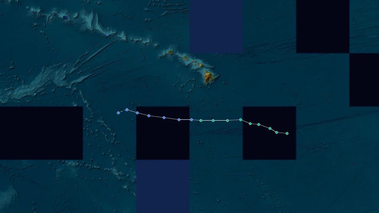
The track record begins at 00:00 UTC on August 22, when the circulation was centered near 25.4°N, 124.9°E with maximum sustained winds of 30 knots. Three hours later, the best-track record placed the system at 25.5°N, 124.9°E with 35-knot winds. The circulation then moved steadily toward the Taiwan region, passing 25.9°N, 124.0°E at 09:00 UTC and 26.0°N, 123.3°E at 12:00 UTC. By the evening of August 22, the center had shifted to roughly 25.4°N, 122.9°E. These positions and wind estimates are contained in the published JMA best-track dataset.
Agora
The storm's initial location is important because it removes one common misconception about its geography. Gaenari did not originate in Okinawa waters and did not make a direct passage across Okinawa Island. Its early circulation was east of Taiwan, while the most exposed Japanese areas associated with this broader tropical-weather episode were in the southern Ryukyu Islands, particularly the Sakishima chain. That distinction is especially useful when reconstructing the storm from satellite-track maps, because several tropical cyclones were moving through the same broad region during the same week.
The JMA record shows Gaenari moving rapidly across the waters east and north of Taiwan. At 00:00 UTC on August 23, the center was near 25.4°N, 122.6°E. By 03:00 UTC it was near 25.5°N, 122.5°E, and by 06:00 UTC it had reached 25.3°N, 120.9°E. At 09:00 UTC, the center was at 24.5°N, 120.1°E. The system was therefore already crossing the Taiwan-area weather regime less than 24 hours after the beginning of the published best-track sequence.
Agora
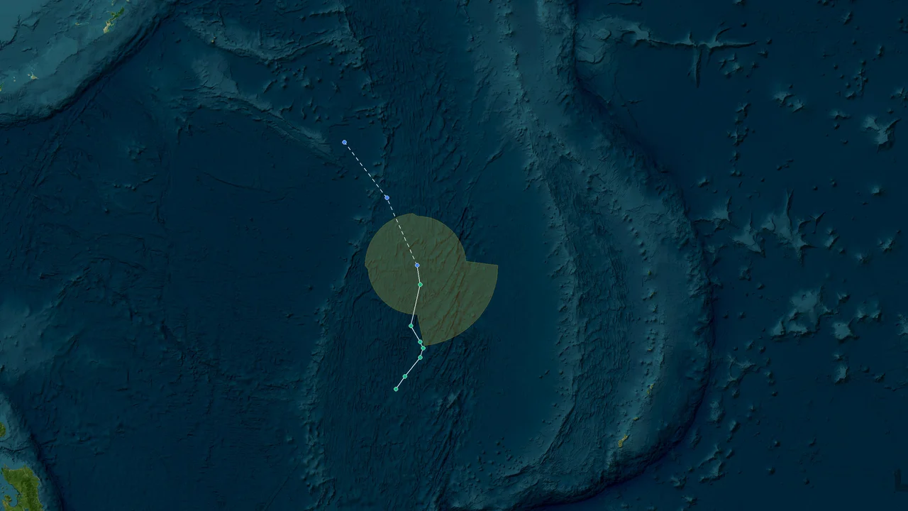
That pace continued. At 12:00 UTC on August 23, Gaenari was analyzed near 24.1°N, 119.2°E. Three hours later it was near 23.3°N, 118.7°E, followed by a temporary slowdown in longitude during the evening. At 18:00 UTC the center was near 23.9°N, 118.7°E, and at 21:00 UTC it was near 23.7°N, 118.6°E. The track then curved back toward the northwest, placing the center near 24.7°N, 119.2°E at 00:00 UTC on August 24.
Agora
This track explains why Gaenari produced a complicated weather picture despite its modest peak intensity. The circulation crossed a narrow and highly populated maritime region between Taiwan and the Chinese coast, where the distinction between a cyclone's center and its broader rain and wind field becomes important operationally. A storm does not need typhoon-force winds to produce dangerous coastal conditions, heavy showers, squalls, reduced visibility, or rough seas.
JMA's best-track wind analysis also shows how broad the system could become. At several points on August 23, the radius of the 15-meter-per-second wind field was listed as large as 300 nautical miles on the major axis. That corresponds to about 560 kilometers. The same record shows a smaller axis of roughly 180 nautical miles during that phase.
Agora
A broad gale field can cover a much larger area than the storm's strongest inner circulation. For coastal forecasters, that difference matters operationally even when the central pressure and maximum wind speed remain moderate. Marine operators can encounter strong winds well away from the center, while rainfall can extend farther still when the cyclone interacts with monsoon moisture and surrounding atmospheric disturbances.
The system was also part of a much larger tropical pattern. On August 22 and 23, Gaenari shared the western North Pacific and South China Sea with other named or developing systems. Narra was active to the southwest, while Saudel was a much stronger cyclone farther east and Atsani was developing later in the sequence. By August 24, four tropical systems were circulating across the broader Northwest Pacific and South China Sea environment. The concentration of systems complicated the regional weather picture, particularly because the storms could alter moisture transport and monsoon flow over East Asia. Reuters later described the group as a rare concentration of four tropical systems in the region.
The Philippine connection: Gaenari and Bagyong Neneng
Gaenari also carried a different name in Philippine weather operations. PAGASA monitored the system as Gaenari, formerly designated locally as Neneng, while it remained outside the Philippine Area of Responsibility. PAGASA's August 24 bulletin listed "Tropical Depression Gaenari (formerly 'Neneng')" among the systems being monitored outside the PAR. At that stage, the agency placed the depression about 520 kilometers north of Itbayat, Batanes, with maximum sustained winds of 55 km/h and gusts of up to 70 km/h.
The local name is significant because Philippine weather reporting can use a domestic name even when the same cyclone already has an international name assigned through the WMO regional system. In practical terms, residents searching Philippine forecasts could therefore encounter both Gaenari and Neneng referring to the same system.
Gaenari did not trigger a Tropical Cyclone Wind Signal in the Philippines. PAGASA's published information kept the system outside the PAR, while weather effects over Luzon were associated primarily with the southwest monsoon, or habagat, rather than a direct landfall by Gaenari. The Philippine News Agency reported that Gaenari was already outside the PAR near Taiwan but could still enhance the southwest monsoon.
That distinction is visible in the operational warnings. PAGASA's five-level Tropical Cyclone Wind Signal system is used when tropical-cyclone winds pose a direct threat to Philippine communities. No Tropical Cyclone Wind Signal was hoisted for Gaenari anywhere in the country. Instead, local forecasts focused on monsoon rainfall, thunderstorms, winds, and sea conditions. PAGASA's August 24 forecast, for example, warned of occasional rain in Batanes and the possibility of flash floods or landslides from moderate to heavy rainfall associated with the southwest monsoon.
A storm can remain outside the PAR and still influence local weather by strengthening the monsoon circulation. During Gaenari's earlier phase, Philippine authorities therefore had reason to monitor the system even without issuing a cyclone wind signal. Farmers, fishers, and coastal communities can face weather hazards from the surrounding monsoon environment even when the cyclone center remains hundreds of kilometers away.
The Department of Agriculture's Cagayan Valley regional office also advised farmers to harvest crops that were ready, move seeds and agricultural materials to elevated locations, protect livestock, and keep irrigation channels clear. Fishers were advised to secure boats and fishing equipment and to monitor marine warnings. Those precautions reflected the broader weather setup rather than a direct Gaenari landfall over the Philippines.
Cagayan Valley DA
The Philippines therefore occupied an important position in Gaenari's wider weather footprint without becoming a landfall location. Batanes and northern Luzon were close enough to the cyclone environment to require continued monitoring, while the southwest monsoon supplied additional moisture and rainfall.
Vietnam was farther outside Gaenari's direct track. The system did not make landfall there, and the cyclone's main landfall impact occurred much farther north in Fujian. At the same time, Vietnam and the northern South China Sea were part of the same broader tropical-weather regime, with other systems such as Narra producing separate hazards. The regional pattern included multiple cyclones and monsoon interactions rather than one isolated storm moving through an otherwise quiet atmosphere.
Across the Taiwan Strait: A Tropical Storm Hits the Fujian Coast
By August 24, Gaenari was moving toward the Fujian coast. The JMA best-track record placed the center at 24.7°N, 119.2°E at 00:00 UTC, 24.8°N, 119.1°E at 03:00 UTC, and 24.9°N, 118.6°E at 06:00 UTC. At 09:00 UTC, the center was near 23.6°N, 118.3°E, followed by a position near 23.6°N, 117.4°E at 12:00 UTC.
Agora
The JMA series records 35-knot maximum sustained winds through much of this period before the final landfall stage. Its minimum analyzed central pressure for the storm was 996 hPa. The published dataset lists the system's latest analyzed position at 24.0°N, 117.0°E at 18:00 UTC, after which the best-track wind field was set to zero. The dataset records the storm's JMA lifetime as beginning at 03:00 UTC on August 22 and ending at 09:00 UTC on August 24.
Agora
The 996 hPa value is therefore part of the published JMA best-track dataset. The pressure minimum should not be confused with the pressure reported at landfall by Chinese authorities, because different agencies may analyze a tropical cyclone at different times, locations, and using different operational procedures.
The Hong Kong Observatory was also tracking the system as it crossed the waters north of the South China Sea. At 4 p.m. on August 23, HKO placed Tropical Depression Gaenari near 25.2°N, 121.0°E, with maximum sustained winds of about 55 km/h, and forecast a west-southwestward movement toward the Taiwan Strait.
GovHK
At 8 p.m. that evening, HKO placed Gaenari near 24.8°N, 120.7°E. By 5 a.m. on August 24, the center was near 24.4°N, 119.7°E, with estimated maximum sustained winds of about 45 km/h. HKO warned of strong winds in its South China coastal waters bulletin while the depression continued westward toward Fujian.
GovHK
At noon on August 24, HKO placed Gaenari near 24.7°N, 119.1°E with maximum sustained winds of about 45 km/h. The bulletin forecast the system to move west slowly across the vicinity of the Taiwan Strait and dissipate gradually.
The track was therefore not a simple straight-line crossing. Gaenari moved westward and southwestward across the Taiwan region before turning toward the Fujian coast. The center's movement, the broad wind field, and the surrounding moisture field all affected the practical weather threat.
The storm's final intensification was recorded by China's weather authorities. At about 11 a.m. local time on August 24, roughly 90 minutes before landfall, Gaenari strengthened from a tropical depression into a tropical storm, with maximum sustained winds of 18 meters per second near the center. It crossed the coast at about 12:30 p.m. near Zhangban Township in Quanzhou, Fujian.
China.org.cn
China's National Meteorological Center of the China Meteorological Administration was operating within a wider national warning system as the storm approached. Chinese reporting identified Gaenari as the 20th named storm in the country's tropical-cyclone numbering system. That annual number is an identification sequence, not an indication that the storm had reached the intensity category implied by the English word "typhoon." At landfall, the system was a tropical storm by the reported wind speed.
Hainan Government
The distinction is useful because terminology varies across agencies. China commonly refers to numbered tropical cyclones as "typhoons" in seasonal numbering and public reporting even when a system's instantaneous intensity is below the typhoon threshold used in some international classification schemes. For an English-language retrospective, the most precise description of Gaenari at landfall is Tropical Storm Gaenari.
Why the Taiwan Strait crossing mattered
The Taiwan Strait is narrow compared with the open western Pacific, and a cyclone crossing it can affect coastal communities on both sides within a short period. Even a moderate tropical cyclone can generate strong coastal winds, high waves, squalls, and periods of intense rainfall when the circulation interacts with nearby terrain.
Gaenari's track also placed it close to southeastern China's densely populated coastal corridor. Fujian has extensive coastal settlements, ports, fishing activity, aquaculture, transport infrastructure, and river systems. Rain falling over short distances can run rapidly from hills and urban surfaces into rivers and drainage channels, making the hydrological consequences different from those of wind exposure alone.
Chinese flood-control authorities responded to that rainfall risk. On August 24, China's Ministry of Water Resources activated a Level-IV flood-control emergency response for Fujian at 5 p.m. The ministry warned that rainfall associated with Gaenari could raise water levels in the Minjiang, Jiulong, Tingjiang, and other coastal rivers. It also warned that some small and medium-sized rivers could rise above warning levels.
China Daily
A working group was sent to the front lines to assist with typhoon, rainstorm, and flood prevention. The ministry instructed local water authorities and river-basin management agencies to strengthen monitoring, forecasting, warning, emergency shifts, and consultation procedures.
China Daily
The timing is important. The flood-control response was activated several hours after landfall, showing that the threat did not end when the center crossed the coast. Tropical cyclones frequently transition from a wind-dominated coastal hazard to a rainfall and river-flood hazard after landfall. The circulation can continue transporting tropical moisture inland even as the maximum wind speed decreases.
At 8 p.m. on August 24, the Hong Kong Observatory placed Gaenari about 100 kilometers north-northeast of Xiamen and forecast a slow west-northwestward movement into inland Fujian. HKO described the system as a tropical depression at that stage.
That rapid post-landfall weakening is consistent with the storm's short lifetime and limited inland circulation. Once a tropical cyclone loses its oceanic heat and moisture source and encounters land friction and terrain, its organized low-level circulation can deteriorate quickly. Rainfall, however, can continue even after the storm has ceased to meet tropical-storm intensity criteria.
Gaenari's final JMA track point came at 18:00 UTC on August 24, near 24.0°N, 117.0°E, with the wind field recorded at zero. The best-track archive lists the storm's minimum pressure at 996 hPa and its maximum sustained wind at 35 knots during its strongest analyzed phase.
Agora
The Chinese landfall observation was different: 18 meters per second and 998 hPa at approximately 12:30 p.m. local time. Both records can coexist because they describe different stages of the storm and come from different operational analysis systems.
A short storm with a surprisingly long weather footprint
Gaenari lasted only a few days, but its weather footprint was spread across several jurisdictions. Taiwan sat directly beneath the storm's track. The Philippines monitored the system because of its proximity to the PAR and its interaction with the southwest monsoon. Hong Kong's marine authorities issued coastal-weather information because the circulation was moving through the Taiwan Strait and adjacent South China coastal waters. Fujian then received the direct landfall.
The Japanese connection was more indirect. The southern Ryukyu Islands were part of the broader tropical-cyclone environment during the same period, but Gaenari's center did not travel through Okinawa Island waters in the manner implied by the original headline that incorrectly described an "Okinawa waters" origin. The more accurate geographic description is that Gaenari formed east of Taiwan and moved through the Taiwan region before reaching Fujian.
That distinction also separates Gaenari from Saudel, which was a much stronger system and affected the Ryukyu region more directly. Reports from late August described significant impacts from Saudel in Okinawa and the Amami Islands, including power outages and flight cancellations. Those impacts should not be attributed to Gaenari.
For the same reason, rainfall observations from Okinawa should not be assigned to Gaenari without a specific station-level source. No unsupported 199.0-millimeter observation is used here. The storm's verified track and official regional warnings provide a stronger basis for reconstructing its physical footprint.
Rainfall Outlasts the Wind: Gaenari’s Lasting Threat to Fujian
After landfall, flooding and river levels posed a greater threat than the storm's winds. Gaenari weakened as it moved inland, but its moisture continued to feed rain over Fujian and surrounding areas. China's flood-control response reflected that shift from a coastal wind hazard toward a hydrological hazard.
China Daily
The physical geography of Fujian helps explain why rainfall can remain dangerous after a tropical cyclone weakens. Much of the province is mountainous or hilly, with narrow river valleys and densely developed coastal plains. Heavy rain falling upstream can increase river levels downstream after the storm center has already moved away. Urban drainage can also be overwhelmed when intense rainfall arrives faster than water can be removed.
Gaenari's landfall near Quanzhou placed the system within a heavily developed part of southeastern China. Quanzhou's coastal economy includes ports, manufacturing, fisheries, aquaculture, logistics, and dense urban and suburban settlements. A short-lived storm moving rapidly through the region can therefore create operational disruptions even if its peak wind category remains below that of a major typhoon.
The National Meteorological Center and other Chinese agencies were also dealing with several tropical systems at the same time. The simultaneous presence of Narra, Saudel, Gaenari, and Atsani meant that rainfall risk could not be evaluated solely from one storm's center position. Moisture transport, monsoon flow, and neighboring cyclones were all part of the larger weather setup. Reuters reported that China was preparing for prolonged heavy rainfall as multiple tropical systems affected southern and coastal areas.
The resulting weather pattern was geographically uneven. Areas close to Gaenari's center faced the most direct wind and rainfall effects, while areas farther away could still experience monsoon showers, thunderstorms, rough seas, or rain bands. This is one reason a tropical cyclone's track line should never be treated as a complete map of its hazard footprint.
Taiwan: a fast-moving passage across the island's weather environment
Gaenari's center passed north and west of Taiwan during its rapid transition toward the strait. The storm did not make a Taiwanese landfall. Instead, the island was positioned between the cyclone's circulation and the surrounding monsoon flow.
The system's movement from 25.4°N, 122.6°E around 00:00 UTC on August 23 to 24.1°N, 119.2°E by 12:00 UTC shows how quickly the center moved toward the Taiwan Strait.
Agora
Such a rapid track can shorten the warning window for marine interests even when the storm itself is not exceptionally intense. Fishing vessels, ferries, port operations, and smaller coastal craft are sensitive to wind and wave conditions well before a tropical cyclone reaches typhoon strength.
The storm's broad 15-meter-per-second wind field also meant that its operational footprint was much wider than the small area directly surrounding the center. The JMA record lists a major-axis radius of up to 300 nautical miles during August 23.
Agora
Hong Kong and the northern South China Sea
Hong Kong was not a Gaenari landfall location, but the Hong Kong Observatory tracked the storm as part of its marine-weather operations. HKO bulletins repeatedly reported Gaenari's location and movement while warning of strong winds in portions of the South China coastal waters.
On the night of August 23, HKO placed Gaenari near 24.7°N, 120.5°E and later near 24.6°N, 120.4°E. By early August 24, the center had moved closer to the Fujian coast.
GovHK
Hong Kong's own local weather was also influenced by the broader unsettled pattern. HKO forecasts called for showers and squally thunderstorms under the influence of a broad trough and active southerly flow. The presence of Narra farther southwest added another source of tropical moisture and instability.
The result was a regional marine-weather problem rather than a direct tropical-cyclone emergency for Hong Kong. This distinction matters for retrospective reporting because a weather agency can issue marine warnings even when a tropical cyclone is not threatening the city directly.
The Philippines: monsoon effects without a direct cyclone strike
Gaenari's Philippine impact was primarily indirect. PAGASA's records consistently identified the system as outside the PAR. The agency also linked local rainfall to the southwest monsoon.
The local designation Neneng remained important in Philippine reporting. The system was described as Tropical Depression Gaenari, formerly Neneng, and Philippine government agencies continued to advise residents and marine users to monitor PAGASA bulletins.
No Tropical Cyclone Wind Signal was raised for Gaenari. The absence of a signal does not mean that all weather associated with the system was benign. It means the agency did not identify a direct threat from tropical-cyclone winds that met the criteria for the country's five-level wind-signal system.
For northern Luzon, the southwest monsoon remained the more immediate source of rain and thunderstorms. Batanes, in particular, was monitored for periods of moderate to heavy rainfall that could trigger flash flooding or landslides.
This is a useful example of how tropical cyclone hazards and monsoon hazards overlap. A cyclone can alter the regional pressure and wind pattern, strengthening moisture transport even when its center stays outside a warning area.
Japan: separating Gaenari from the wider storm cluster
Japan's most exposed areas during this period were the southern Ryukyu Islands, particularly the Sakishima chain, but the strongest reported impacts in the Japanese islands were associated with other tropical systems, especially Saudel. Reuters reported power outages affecting about 35,000 homes and 92 flight cancellations in connection with Saudel's impacts in Okinawa and the Amami Islands.
Gaenari's own track remained east of Taiwan before crossing the Taiwan Strait. The storm therefore should not be described as having crossed Okinawa waters or made a Japanese landfall.
This geographic separation is important when several storms are active simultaneously. A single satellite image can show multiple circulation centers across the western Pacific, but each system has its own track, wind field, rainfall structure, and hazard area. Assigning one storm's damage to another can distort the historical record.
Vietnam: outside Gaenari's track
Vietnam did not receive a direct Gaenari landfall. The country's weather was affected by the same broader tropical environment, but Gaenari's center remained far to the north and east of Vietnam.
Narra was the more relevant tropical system for parts of the South China Sea and southern China during the same period. HKO bulletins, for example, tracked Narra over the Beibu Gulf while monitoring Gaenari near Taiwan and Fujian.
For Vietnam, the correct retrospective description is therefore limited: Gaenari was part of a crowded western North Pacific and South China Sea pattern, but it did not produce a comparable direct landfall threat over Vietnam.
The final hours and dissipation
Gaenari's final phase was brief. After reaching the Fujian coast, the system weakened inland. JMA's final analyzed position at 18:00 UTC on August 24 was near 24.0°N, 117.0°E, with no remaining best-track wind field.
Agora
The storm's JMA archive gives a minimum pressure of 996 hPa and a maximum sustained wind of 35 knots. Its track length was about 1,392 kilometers, with an average movement speed of approximately 22.1 km/h over the JMA track period.
CoDL
That average speed captures the character of the system better than a single intensity number. Gaenari moved from east of Taiwan to Fujian in a little more than two days, crossed a narrow maritime corridor, passed close enough to affect multiple coastal warning zones, and then weakened quickly after landfall.
The storm's legacy is not about exceptional power. It is about speed, geography, and timing. Gaenari raced across the Taiwan region and Taiwan Strait before reaching Fujian, while its broader moisture and wind environment affected weather operations in the Philippines, Taiwan, Hong Kong's coastal waters, and southeastern China.
The final scientific record remains straightforward: JMA's best-track archive gives Gaenari a minimum central pressure of 996 hPa, a maximum sustained wind of 35 knots, and a track ending on August 24. Chinese reporting records a 12:30 p.m. Fujian landfall with 18-meter-per-second winds and a central pressure of 998 hPa.
Agora
Lessons from Gaenari: Why Wind Category Doesn't Tell the Full Story
Gaenari demonstrates why tropical-cyclone risk cannot be reduced to the storm's peak wind category. The system was not a long-lived major typhoon, yet its rapid movement through the Taiwan Strait and landfall near Quanzhou created a sequence of hazards that extended beyond the period of maximum wind.
The first lesson is geographic. The center of a tropical cyclone is only one part of the system. Gaenari's center moved rapidly, but the wind field extended hundreds of kilometers from it. The JMA record's 300-nautical-mile major-axis radius for 15-meter-per-second winds illustrates how far the circulation could reach.
Agora
The second lesson is temporal. Landfall is not necessarily the end of the hazard. Fujian's flood-control response was activated after Gaenari crossed the coast because rainfall and river levels remained a concern. The Ministry of Water Resources specifically identified possible rises in major rivers and warned that smaller rivers could exceed warning levels.
China Daily
The third lesson is regional. Gaenari operated within a crowded tropical environment. Narra, Saudel, and Atsani were active in the same broad period. Their combined influence affected moisture transport, monsoon circulation, marine conditions, and forecasting workload across East Asia.
The fourth lesson concerns naming. International and domestic cyclone names can coexist. Gaenari was the international name, while PAGASA had previously designated the system Neneng. Philippine bulletins therefore referred to "Tropical Depression Gaenari (formerly Neneng)."
The fifth lesson is that warning systems are jurisdiction-specific. PAGASA's Tropical Cyclone Wind Signal system did not activate for Gaenari because the cyclone remained outside the PAR and did not pose the required direct wind threat to the Philippines. At the same time, PAGASA still monitored the storm because it could influence the southwest monsoon.
The sixth lesson is the value of agency-specific terminology. JMA's best-track data provide a consistent historical track and intensity record. HKO provides detailed marine and local weather bulletins. PAGASA provides Philippine-area warnings and local naming. China's National Meteorological Center and water authorities provide mainland warnings and flood-control information. These products describe different operational needs, so their numbers should not be treated as interchangeable observations from the same moment.
The seventh lesson is the need to separate simultaneous storms. Saudel's impacts in Okinawa should not be assigned to Gaenari. Narra's Beibu Gulf impacts should not be attributed to Gaenari. Atsani's development should not be folded into Gaenari's track. A reliable retrospective follows each circulation independently before describing the broader weather pattern.
The eighth lesson is that a short-lived storm can still leave a complex forecast history. Gaenari's JMA lifetime was only about 63 hours from the agency's recorded genesis to its final analyzed stage. Yet within that period it crossed several operational forecast regions and moved from open western Pacific waters toward a heavily populated mainland coast.
CoDL
The ninth lesson is that pressure alone cannot describe hazard. Gaenari's minimum JMA pressure was 996 hPa, while the Chinese landfall analysis was 998 hPa. Those values are useful for historical intensity records, but rainfall, wind-field size, forward speed, terrain, coastal exposure, and river conditions determine the actual consequences for communities.
The tenth lesson is simple for future storm analysis: follow the center, the wind field, the rainfall, the warnings, and the post-landfall hydrology separately. Gaenari's August 2026 passage provides a compact example of why those five elements need to be read together.
Frequently Asked Questions About Storm Gaenari
- When did Tropical Storm Gaenari form?
The JMA best-track archive begins the system at 03:00 UTC on August 22, 2026. The published track data also contain a 00:00 UTC position near 25.4°N, 124.9°E, before the system's named tropical-cyclone phase was established in the JMA lifetime record.
Agora
- Where did Gaenari form?
Gaenari developed east of Taiwan in the western North Pacific. Its early track remained well away from Okinawa Island. The center then moved westward toward the Taiwan region before crossing the Taiwan Strait and approaching Fujian.
Agora
- Why was Gaenari also called Neneng in the Philippines?
PAGASA uses its own local naming system for tropical cyclones affecting or approaching the Philippine Area of Responsibility. Gaenari had previously been designated Neneng in Philippine operations, so PAGASA referred to it as Tropical Depression Gaenari, formerly Neneng.
- Did the Philippines issue a Tropical Cyclone Wind Signal for Gaenari?
No. Gaenari remained outside the Philippine Area of Responsibility, and no Tropical Cyclone Wind Signal was hoisted for the system. PAGASA nevertheless monitored it because the cyclone could influence the southwest monsoon and local rainfall.
- What was Gaenari's maximum intensity?
The JMA best-track record gives a maximum sustained wind of 35 knots and a minimum central pressure of 996 hPa. Chinese authorities reported that Gaenari strengthened to a tropical storm shortly before Fujian landfall, with maximum sustained winds of 18 meters per second and a central pressure of 998 hPa at landfall.
Agora
- Where did Gaenari make landfall?
Gaenari made landfall at about 12:30 p.m. local time on August 24 near Zhangban Township in Quanzhou, Fujian Province, on China's southeastern coast.
China.org.cn
- Was Gaenari a typhoon when it hit Fujian?
It is more precise in English to describe Gaenari as a tropical storm at landfall. Chinese reporting identified it as the year's 20th numbered typhoon in the country's tropical-cyclone numbering sequence, but that number is an annual identification convention rather than a statement that the storm had typhoon-level intensity at landfall.
China.org.cn
- What was the strongest wind reported at landfall?
The reported maximum sustained wind near Gaenari's center at landfall was 18 meters per second, equivalent to Force 8 under the Chinese wind-force scale.
China.org.cn
- What was Gaenari's lowest central pressure?
The JMA best-track dataset lists a minimum central pressure of 996 hPa. The pressure reported at Fujian landfall was 998 hPa, reflecting a different point in the storm's life cycle and a different operational analysis.
Agora
- Did Gaenari affect Taiwan?
Yes. The storm's center crossed the Taiwan-area weather environment and then entered the Taiwan Strait. Its track brought the circulation close to Taiwan before it moved toward the Fujian coast.
Agora
- Did Gaenari hit Okinawa?
No. Gaenari's center did not make a direct Okinawa landfall or originate in Okinawa waters. Its verified track began east of Taiwan and progressed toward the Taiwan Strait and Fujian. Some significant Okinawa impacts reported during the same period were associated with the separate, stronger Typhoon Saudel.
Agora
- Did Gaenari affect Hong Kong?
Gaenari did not make landfall in Hong Kong, but the Hong Kong Observatory monitored it in its South China coastal waters bulletins. HKO issued strong-wind warnings for coastal-water areas while the depression crossed the Taiwan Strait and moved toward Fujian.
- Did Gaenari affect Vietnam?
Gaenari did not make a direct landfall in Vietnam. Its main landfall was in Fujian, while other tropical systems in the same period affected the South China Sea and areas closer to Vietnam.
- Why did Fujian remain at risk after Gaenari weakened?
Rainfall and river responses can continue after a tropical cyclone loses its strongest winds. China's Ministry of Water Resources activated a Level-IV flood-control emergency response for Fujian because rainfall from Gaenari was expected to raise water levels in several major rivers and potentially push smaller rivers above warning levels.
China Daily
- How large was Gaenari's wind field?
The JMA best-track wind data show a maximum major-axis radius of about 300 nautical miles for the 15-meter-per-second wind field during part of August 23. That is roughly 560 kilometers, demonstrating that the broader wind circulation extended far beyond the storm center.
Agora
- How long did Gaenari last?
The Digital Typhoon archive based on JMA best-track information gives a JMA lifetime of about 63 hours, from August 22 to August 24.
CoDL
- How fast did Gaenari move?
Its JMA track covered approximately 1,392 kilometers, with an average movement speed of about 22.1 km/h across the archived track period. The storm's rapid progression from east of Taiwan toward Fujian was one of its most distinctive characteristics.
CoDL
- Why did Gaenari have both an international and a Philippine name?
Western North Pacific tropical cyclones can receive an international name through RSMC Tokyo's regional naming system and a local Philippine name when they fall under PAGASA's naming area. The two names can refer to the same cyclone. In this case, Gaenari was the international name and Neneng was the Philippine local designation.
World Meteorological Organization
- Was Gaenari the only tropical cyclone active near East Asia?
No. The period featured several simultaneous systems, including Saudel, Narra, Gaenari, and Atsani. The multiple-cyclone environment contributed to widespread tropical weather across the western North Pacific and South China Sea.
- What is the best official source for Gaenari's historical track?
For the historical track and intensity record, the JMA best-track dataset is the primary reference used in this report. The Digital Typhoon archive reproduces the JMA best-track information and identifies the source as Japan Meteorological Agency Best Track Data.
Agora
- Which agency should be consulted for Philippine warnings?
PAGASA is the authoritative Philippine weather agency for tropical-cyclone warnings, including the Philippine Area of Responsibility and Tropical Cyclone Wind Signal system. Its August 24 bulletin identified Gaenari as outside the PAR and formerly known locally as Neneng.
- Which agency handled China's national tropical-cyclone forecasting?
China's National Meteorological Center operates under the China Meteorological Administration and provides national meteorological monitoring and forecasting. During Gaenari's landfall period, Chinese meteorological and water-management agencies coordinated rainfall, cyclone, and flood-control information.
Hainan Government
- Why are JMA and Chinese landfall pressures different?
A tropical cyclone's central pressure changes continuously, and agencies may use different analysis times and methods. Gaenari's JMA minimum was 996 hPa, while the Chinese landfall report gave 998 hPa. These are not contradictory measurements of the exact same moment; they describe different stages of the storm.
Agora
- What made Gaenari unusual?
Gaenari was not unusual because of exceptional peak intensity. Its notable characteristics were its short lifetime, rapid movement, passage through the Taiwan Strait, brief strengthening before Fujian landfall, and broad regional weather footprint during a period of multiple active tropical systems.
CoDL
- What is the most important fact to remember about Gaenari?
Gaenari was a fast-moving tropical cyclone that crossed from east of Taiwan toward Fujian in roughly two days. It made landfall near Zhangban Township in Quanzhou at about 12:30 p.m. on August 24, with 18-meter-per-second sustained winds, before weakening inland.
China.org.cn
Sources and Data Notes
The storm chronology in this report is based primarily on the JMA best-track record, supplemented by official operational information from PAGASA, the Hong Kong Observatory, China's National Meteorological Center and water-management authorities, and contemporary reporting from Xinhua and other established news services.
The JMA track data used here are reproduced in the National Institute of Informatics' Digital Typhoon archive, which explicitly identifies the dataset as Japan Meteorological Agency Best Track Data. The archive records Gaenari as Typhoon 202620, with a 996 hPa minimum pressure, 35-knot maximum sustained wind, and track data from August 22 through August 24.
CoDL
The regional naming framework follows the ESCAP/WMO Typhoon Committee system administered operationally by RSMC Tokyo. The WMO explains that RSMC Tokyo assigns names from the adopted western North Pacific and South China Sea list when tropical cyclones reach the relevant naming threshold. Gaenari is the Korean-contributed name in the applicable sequence.
Japan Meteorological Agency
PAGASA records were used for the Philippine local designation Neneng, the storm's position outside the PAR, the absence of a Tropical Cyclone Wind Signal, and the interaction with the southwest monsoon.
Hong Kong Observatory bulletins were used for the storm's positions in the Taiwan Strait and the marine warnings issued for South China coastal waters.
GovHK
Chinese reporting was used for the Fujian landfall time, Zhangban Township location, landfall wind speed, and the subsequent flood-control response.
China.org.cn
Gaenari's final scientific record is therefore anchored to a clear sequence: formation east of Taiwan, rapid movement across the Taiwan region, passage through the Taiwan Strait, renewed tropical-storm strength before Fujian landfall, and weakening inland on August 24, 2026.
Agora